I-10, Islamabad
Pakistan geography stubsSectors of IslamabadWikipedia indefinitely semi-protected pages

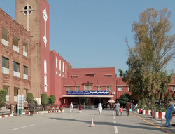
I-10 is a sector of Islamabad, Pakistan. It is a lightly built area, located on the southwestern edge of the city.I-10 borders Rawalpindi to the south and neighbors I-9 and I-11, while sectors H-9, H-10, and H-11 are located adjacent. Like most other I-sectors, I-10 is primarily a part of the industrial zone. It consists of open land with dense vegetation. It is a densely populated area.
Excerpt from the Wikipedia article I-10, Islamabad (License: CC BY-SA 3.0, Authors, Images).I-10, Islamabad
Kurang Road, Islamabad I-10
Geographical coordinates (GPS) Address Nearby Places Show on map
 Continue reading on Wikipedia
 Geographical coordinates (GPS)
| Latitude | Longitude |
|---|---|
| N 33.646873251352 ° | E 73.03616470925 ° |
Address
Dwatson
Kurang Road
44000 Islamabad, I-10
Islamabad Capital Territory, Pakistan
Open on Google Maps