place

Cheddar Reservoir

Cheddar, SomersetDrinking water reservoirs in EnglandReservoirs in SomersetSites of Special Scientific Interest in SomersetSites of Special Scientific Interest notified in 1972
Wetland Sites of Special Scientific Interest
Cheddarreser
Cheddarreser

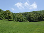
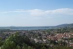
Cheddar Reservoir is an artificial reservoir in Somerset, England, operated by Bristol Water. Dating from the 1930s it has a capacity of 1350 million gallons (6,140,000 cubic metres). The reservoir is supplied with water taken from the Cheddar Yeo river in Cheddar Gorge. The inlet grate for the 54 inches (1.4 m) water pipe that is used to transport the water can be seen immediately upstream from the sensory garden in Cheddar Gorge. It lies to the west of the village of Cheddar and south east of the town of Axbridge. Because of this it is sometimes known as Axbridge Reservoir. It is roughly circular in shape, and surrounded by large earth banks which are grazed by sheep.

Excerpt from the Wikipedia article Cheddar Reservoir (License: CC BY-SA 3.0, Authors, Images).

Cheddar Reservoir
Black Lane, Sedgemoor

Geographical coordinates (GPS) Address Website Nearby Places
placeShow on map

Wikipedia: Cheddar ReservoirContinue reading on Wikipedia

Geographical coordinates (GPS)

Latitude Longitude
N 51.2806 ° E -2.8014 °
placeShow on map

Address

Bristol Corinthian Yacht Club

Black Lane
BS26 2DP Sedgemoor
England, United Kingdom
mapOpen on Google Maps

Website
bristolcorinthian.org.uk

linkVisit website

Cheddarreser
Cheddarreser
Share experience

Nearby Places

Cheddar Wood
Cheddar Wood

Cheddar Wood (grid reference ST445552) is an 86.9-hectare (215-acre) biological Site of Special Scientific Interest at Cheddar in the Mendip Hills, Somerset, England, notified in 1967. Cheddar Wood and the smaller Macall's Wood near Cheddar Gorge are what remains of the wood of the Bishops of Bath and Wells in the thirteenth century and of King Edmund the Magnificent's wood in the tenth. It lies on carboniferous limestone with rock showing through the thin topsoils. In 1801 the wood was larger than it is today. During the nineteenth century its lower fringes were grubbed out to make strawberry fields, most of which have reverted to woodland. It was coppiced until 1917.This site comprises a range of habitats which includes ancient and secondary semi-natural broadleaved woodland, unimproved neutral grassland and a mosaic of calcareous grassland and acidic dry dwarf-shrub heath. Two nationally rare plant species are present. Additional interest lies in the invertebrate fauna. Cheddar Wood is one of only a few English stations for starved wood-sedge (Carex depauperata), which grows in the lane along the east side of the wood. The nationally rare purple gromwell (Lithospermum purpurocaeruleum) grows in the lane along the west side of the wood.Butterflies include silver-washed fritillary (Argynnis paphia), dark green fritillary (Argynnis aglaja), pearl-bordered fritillary (Boloria euphrosyne), holly blue (Celastrina argiolus) and brown argus (Aricia agestis). The slug Arion fasciatus, which has a restricted distribution in the south of England, and the soldier beetle Cantharis fusca also occur.The site is managed as two nature reserves by Somerset Wildlife Trust Cheddar Wood Edge which covers 7.1 hectares (18 acres) of old strawberry fields, is now reverting to semi species-rich limestone grassland and scrub with ancient woodland hedges, and Cheddar Wood itself which has restricted access allowed by permit.

Cheddar, Somerset
Cheddar, Somerset

Cheddar is a large village and civil parish in the Sedgemoor district of the English county of Somerset. It is situated on the southern edge of the Mendip Hills, 9 miles (14 km) north-west of Wells, 11 miles (18 km) south-east of Weston-super-Mare and 18 miles (29 km) south-west of Bristol. The civil parish includes the hamlets of Nyland and Bradley Cross. The parish had a population of 5,755 in 2011 and an acreage of 8,592 acres (3,477 ha) as of 1961.Cheddar Gorge, on the northern edge of the village, is the largest gorge in the United Kingdom and includes several show caves, including Gough's Cave. The gorge has been a centre of human settlement since Neolithic times including a Saxon palace. It has a temperate climate and provides a unique geological and biological environment that has been recognised by the designation of several Sites of Special Scientific Interest. It is also the site of several limestone quarries. The village gave its name to Cheddar cheese and has been a centre for strawberry growing. The crop was formerly transported on the Cheddar Valley rail line, which closed in the late 1960s but is now a cycle path. The village is now a major tourist destination with several cultural and community facilities, including the Cheddar Show Caves Museum.The village supports a variety of community groups including religious, sporting and cultural organisations. Several of these are based on the site of The Kings of Wessex Academy, which is the largest educational establishment.