place

Sørumsand

Viken (county) geography stubsVillages in Akershus

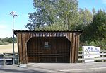
Sørumsand is a small railway town, situated in Lillestrøm Municipality in Akershus in Norway. Sørumsand was the terminus of Urskog-Hølandsbanen also known as "Tertitten".

Excerpt from the Wikipedia article Sørumsand (License: CC BY-SA 3.0, Authors).

Sørumsand
Orderudvegen, Lillestrøm

Geographical coordinates (GPS) Address Nearby Places
placeShow on map

Wikipedia: SørumsandContinue reading on Wikipedia

Geographical coordinates (GPS)

Latitude Longitude
N 59.966666666667 ° E 11.25 °
placeShow on map

Address

Orderudtoppen

Orderudvegen
1920 Lillestrøm
Norway
mapOpen on Google Maps

Share experience

Nearby Places

Blaker Fortress
Blaker Fortress

Blaker Fortress (Blaker skanse) is a former defense facility located at the village of Blaker in Viken county, Norway. It was one of the Norwegian fortresses which were constructed in the period of intense competition among the Baltic powers (Denmark-Norway, Sweden, Russia, Poland and the German states) for northern supremacy. In 1675 Ulrik Frederik Gyldenløve, Governor-general of Norway, indicated an intent to construct a fortress in the Glomma river where Blaker lies as part of his general program of Norwegian fortification upgrades. His objective was a stronghold available both to serve as a safe defensive position when necessary and a location to station troops who could take the offensive against invaders when the opportunity availed itself. Blaker Fortress saw action in 1718, when it was surrounded by the invading Swedish army, but the siege collapsed upon the death of King Charles XII of Sweden in front of Fredriksten Fortress. The 17th and beginning of the 18th century was a period of virtually continuous war or preparation for war, as follows: 1611 to 1613 - Kalmar War 1618 to 1648 - Thirty Years' War 1655 to 1658 – Northern Wars 1673 to 1675 – Fortification Upgrades 1675 to 1679 – Gyldenløve War 1700 to 1721 – Great Northern WarBlaker Fortress was de-commissioned as a fortress in 1820, but remained a military area until 1893. From 1917 to 2003, Statens Husflidsskole (now University College of Akershus conducted classes on site.

Fetsund Bridge
Fetsund Bridge

The Fetsund Bridge (Norwegian: Fetsund bru) refers to two bridges: a road bridge and a railway bridge that cross the Glomma River at Fetsund in the municipality of Fet in Viken county, Norway.The first bridge, a wooden structure, was built in 1860 for the Kongsvinger Line. The municipalities of Fet and Høland split the cost of a road for horses and carts on the downstream side of the bridge. In 1877 the bridge was rebuilt, and the wooden pilings were replaced with stone.The construction of the bridge led to the Bingen Booms at Sørumsand being relocated to Fetsund. After some time, it turned out that the old bridge could lead to large flows of timber clogging when being driven on the river. This led to the construction of a new and higher bridge a few dozen meters upstream from the old wooden bridge. The new railway bridge was made of steel with seven spans, each approximately 60 meters (200 ft) long. This bridge, with a length of 420 meters (1,380 ft), was opened in 1919. This was built as a combined rail and road bridge with a lane on either side. When a new road bridge was later built, the roadways on the 1919 bridge were closed to cars in 1959, and the upstream roadway was converted to use as a walking and cycling route. In the 1980s, both roadways were removed and a narrow footbridge was installed on the north side. This marked the end of one of the last combined rail and road bridges in Norway. To protect the approach to the old railway bridge, the Fetsund Battery was installed on the slope west of the bridge in 1898.After the Second World War, a prefabricated pontoon bridge was stored at Stasjonsstranda, between the bridges, for many years. The New Fetsund Bridge for National Road 22 was opened on December 12, 1959 a few hundred meters downstream from the railway bridge.

Fetsund
Fetsund

Fetsund forms the center of the municipality Lillestrøm Viken, Norway. The name comes from the local geography, Fet means "where water meets grass". As for the -sund part, it simply means 'strait, inlet'. Accordingly, Fetsund is located at the strait of Glomma, Norway's largest river, just before it enters Øyeren nature reservation, and this is the place the logging industry in years past pulled the logs out of the water for transport to steam sawmills. Today, Fetsund and its surrounding areas is a small town and is mainly a residential area with very little industry. The old log industry is gone, but its buildings and site is still preserved as a national museum, Fetsund Lenser. Fetsund's close proximity to Lillestrøm and the nation's capital, Oslo, have been contributing to the fact that the town has grown much larger in recent years. Its small-town qualities, low population density, and closeness to the capital, makes it a preferred place to live. Fetsund's history dates back to the ancient kings' road going from the medieval town of Oslo towards the neighbouring country Sweden. As Fetsund was the shortest distance by ferry or boat over the river Glomma, the place naturally grew into the urbanized area it is today. Now there are two bridges in Fetsund spanning the Glomma, and it is still the only crossing within the area. Fetsund has a church with an altarpiece dating from the 17th century. Fetsund's railway station was built in the 1860s, which is still standing today and is used by people working in Oslo and to a lesser extent Lillestrøm.