place

Chessel Bay

Bays of EnglandHampshire geography stubsLandforms of HampshireLocal Nature Reserves in Hampshire
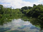
Chessel Bay, Southampton geograph.org.uk 415238

Chessel Bay is a 12.9-hectare (32-acre) Local Nature Reserve on the east bank of the River Itchen in Southampton in Hampshire. It is owned and managed by Southampton City Council. It is part of Solent and Southampton Water Ramsar site and Special Protection Area, and of Lee-on-The Solent to Itchen Estuary, which is a Site of Special Scientific Interest.It comprises a narrow strip of woodland, a parallel strip of shingle and saltmarsh and a substantial area of mudflats. At low tide the mudflats are exposed attracting wading birds and wildfowl: curlew, oystercatchers and dunlin can be seen throughout the year. In winter, the site is also used as a stop-over for other migrating birds such as brent geese. At low tide, mudflats are exposed, and these attract feeding estuary birds. The mudflats are also nationally and internationally important. Local volunteers, Friends of Chessel Bay, team up with the City Council twice a year to combat the large amount of litter which accumulates in the bay, and carry out management of the Reserve.

Excerpt from the Wikipedia article Chessel Bay (License: CC BY-SA 3.0, Authors, Images).

Chessel Bay
Cross Road, Southampton Merry Oak

Geographical coordinates (GPS) Address External links Nearby Places
placeShow on map

Wikipedia: Chessel BayContinue reading on Wikipedia

Geographical coordinates (GPS)

Latitude Longitude
N 50.9112 ° E -1.37553 °
placeShow on map

Address

Chessel Bay Local Nature Reserve

Cross Road
SO19 4BW Southampton, Merry Oak
England, United Kingdom
mapOpen on Google Maps

linkWikiData (Q5093351)
linkOpenStreetMap (644318199)

Chessel Bay, Southampton geograph.org.uk 415238
Share experience

Nearby Places

St Mary's Independent School, Southampton

St Mary's Independent School, formerly named St Mary's College, was an independent day school for boys and girls in Southampton, Hampshire, England. The school was located on the site of a former a country house called Bitterne Grove, built c1790 by Richard Leversuch. In 1910 it was bought by the French order of the Brothers of Christian Instruction and renamed as St Mary’s House. Initially it was a centre for students who were exiled from France due to anti-clerical laws passed there in 1903 and training for the Brotherhood, until the centre was relocated to Highlands College, Jersey, in the Channel Islands. In 1922 it became the first Secondary School for Catholic boys in Southampton, under the name of St Mary’s College, and opened with five Brothers and 30 pupils. During the Second World War rapid expansion of the school took place; the number of pupils passing from 200 at the start of the War to 400 at the end. In 1992 the junior department started taking girls and in 2000 the senior department was opened to girls, and latterly approximately 25% of the pupils were girls. Former pupils are known as Old Simmarians.From 1925 to 1964 Rev Brother Maurice worked at the school. Before WWI he had been sent as a teacher amongst the Blackfoot Indians in Montana and Eskimos on the Yukon River. During the war he served with great distinction in the French Medical Corps. He was twice wounded and also mentioned three times in dispatches for gallantry. He was awarded the Croix de Guerre with palm and two stars, as well as the Médaille Militaire and, for his bravery on the battlefield of Verdun in 1916, the Legion of Honour Military Medal. He was twice headmaster of St Mary’s (1928–31 and 1937–43) and later head of its prep-school, Charlton.In 2013 Ofsted judged the school as 'Good'. In 2018 another inspection judged it to 'Requires Improvement'. In 2019 it was reinspected and judged 'Inadequate'.In 2020 the school went into administration following financial difficulties which had been "significantly impacted" due to the coronavirus pandemic. The school was acquired and refurbished by private investors and re-opened in Sept 2021 as a school for children aged 7–16 with social, emotional and mental health needs, under the new name of Yarrow Heights School.

Itchen Ferry village

Itchen Ferry village was a small hamlet on the East bank of the River Itchen in Hampshire. The village took its name from the small fishing boats that were also used to ferry foot passengers across the river. An Ordnance Survey map of 1911 (NC/03/17894) shows the village to be situated in the area roughly bounded by Sea Road, Oakbank Road, the River Itchen and the railway line in modern Woolston, but also extending along Sea Road towards Peartree Green on the other side of the railway, which cut the village in half in 1866. Neighbouring streets on that same map, Defender Road, Britannia Road and Shamrock Road have a more structured layout and are clearly part of the Victorian enlargement of Woolston. The same map clearly shows the housing in Itchen Ferry village to have a more random layout. An even older map, of 1842 pins Itchen Ferry village more tightly to the area between Sea Road and Vicarage Road. Itchen ferrymen were granted permission to ferry passengers and goods across the River Itchen by the lords of the manors of Woolston and Southampton. Lords of the manor of Woolston were paid in cash. Lords of the manor of Southampton received free passage.The village lost a large part of its livelihood when the Floating Bridge was introduced in 1836, but continued to operate a night service until the late 19th century. The inhabitants always remained fishermen and seafarers. A memorial to Richard Parker of Itchen Ferry village can be seen in the graveyard of Jesus Chapel on Peartree Green. The desperate situation that led to his death in 1884 was the subject of a significant murder trial, Regina v. Dudley & Stephens, that changed English law. Already absorbed into its larger neighbour, Woolston, and subsequently into the borough of Southampton in 1920, Itchen Ferry village was destroyed beyond repair by the Luftwaffe on 26 September 1940 due to its misfortune of being a stone's throw from the Supermarine factory and a short distance up-river from the John I. Thornycroft & Company shipyard. There were over 100 casualties in this one raid.But that was not the only raid. The Luftwaffe had targeted the area on a number of previous occasions. An air raid shelter in the lower region of Sea Road near the railway line is reported as receiving a direct hit on 24 September 1940.The area was subsequently used for training troops that would be fighting in similar ruined villages during the invasion of Europe in 1944.