The Bijlmermeer ([ˈbɛi̯lmərˌmeːr]), or colloquially Bijlmer ([ˈbɛilmər]), is one of the neighbourhoods that form the Amsterdam-Zuidoost borough (Dutch: stadsdeel) of Amsterdam, Netherlands. To many people, the Bijlmer designation is used to refer to Amsterdam Zuidoost as a pars pro toto. The other neighbourhoods in Amsterdam Zuidoost are Gaasperdam, Bullewijk, Venserpolder and Driemond.
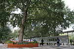
The Bijlmermeer neighbourhood, which today houses almost 50,000 people of over 150 nationalities, was designed as a single project as part of a then innovative Modernist approach to urban design. Led by architect Siegfried Nassuth and team, the original neighbourhood was designed as a series of nearly identical high-rise buildings laid out in a hexagonal grid. The goal was to create open spaces for recreation at grade, elevated roads to reduce pollution and traffic from those same recreation areas, and residences climbing upward offering residents views, clean air, and sunlight. The apartments were meant to attract a suburban population, in the manner of condominium housing. The buildings have several features that distinguish them from traditional Dutch high-rise flats, such as tubular walkways connecting the flats and garages. The blocks are separated by large green areas planted with grass and trees. Each flat has its own garages where cars can be parked.
The Bijlmer was designed with two levels of traffic. Cars drive on the top level, the decks of which fly over the lower levels, pedestrian avenues and bicycle paths. This separation of fast and slow moving traffic is conducive to traffic safety. However, in recent years, the roads are once again being put into a single plane, so pedestrians, cycles and cars travel alongside each other. This is a move to lessen the effects of the 'inhuman' scale of some of the Bijlmer's designs and improve safety using direct sightlines.
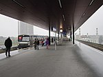
Because of the Bijlmer's peripheral position relative to the city centre, it was decided that metro lines would be built connecting the Bijlmer with other neighbourhoods. The Oostlijn (east line, comprising two lines, numbered 53 and 54) links the Bijlmer to the Central Station of Amsterdam, while the Ringlijn links it with the port area at Sloterdijk.


