place

Pleasley

Bolsover DistrictCivil parishes in DerbyshireMansfield DistrictUse British English from May 2016Vague or ambiguous time from January 2021
Villages in DerbyshireVillages in Nottinghamshire
Pleasley Village
Pleasley Village

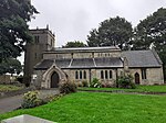
Pleasley listen is a village and civil parish with parts in both Derbyshire and Nottinghamshire. It lies between Chesterfield and Mansfield, 5 miles (8 km) south east of Bolsover, Derbyshire, England and 2.5 miles (4 km) north west of Mansfield, Nottinghamshire. The River Meden, which forms the county boundary in this area, runs through the village. The bulk of the village is in the Derbyshire district of Bolsover, and constitutes a civil parish of the same name. The population of this civil parish at the 2011 Census was 2,305. The part in Nottinghamshire is in the district of Mansfield and is unparished. Pleasley is not mentioned in Domesday when it was part of Glapwell parish.

Excerpt from the Wikipedia article Pleasley (License: CC BY-SA 3.0, Authors, Images).

Geographical coordinates (GPS)

Latitude Longitude
N 53.17345 ° E -1.25044 °
placeShow on map

Address

Park View

Park View
NG19 7QE , Pleasley
England, United Kingdom
mapOpen on Google Maps

Pleasley Village
Pleasley Village
Share experience

Nearby Places

Pleasley Colliery
Pleasley Colliery

Pleasley Colliery is a former English coal mine. It is located to the north-west of Pleasley village, which sits above the north bank of the River Meden on the Nottinghamshire/Derbyshire border. It lies 3 miles (4.8 km) north of Mansfield and 9 miles (14.5 km) south of Chesterfield. From the south it commands a prominent position on the skyline, although less so now than when the winders were in operation and both chimney stacks were in place. The colliery is situated at about 500 ft (152m) above sea level and is aligned on a NE–SW axis following the trend of the river valley at this point. After closure of the colliery in 1986, most of the surface infrastructure was demolished and what remains are the two headstocks which stood above the shafts, the engine-house complex, containing the two steam winders which were used to raise the coal, one dating from 1904 and the other from 1922, and one of the 40 m high brick chimneys which served the steam boiler range. The engine-house complex is a grade 2 listed building and the site has been scheduled as an Ancient Monument. The site is owned and managed by the Land Trust and the licensed occupiers are the Friends of Pleasley Pit restoration group who set the wheels in motion to ensure the preservation of the site and have been responsible for the renovation the two unique steam winders. The parent organisation of the Friends is the Pleasley Pit Trust, a registered charity, which is now undertaking the transformation of the site into a mining heritage centre. The old pit tip was reworked to extract residual coal, after which it was landscaped to create a nature reserve consisting of footpaths and lakes. The two adjacent railway lines were part of an extensive network serving the Nottinghamshire–Derbyshire coal field and the disused tracks have been converted into cycle trails linking the collieries to the west and nearby Hardwick Hall.