place

Adamslie Park

Football venues in ScotlandKirkintillochKirkintilloch Rob Roy F.C.Sports venues completed in 1926Sports venues in East Dunbartonshire
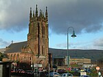
Kirkintilloch Rob Roy Football Club geograph.org.uk 131370

Adamslie Park was formerly a football ground in Kirkintilloch, East Dunbartonshire, Scotland, which was the home ground of Scottish Junior Football Association club Kirkintilloch Rob Roy F.C. until 2014. It was located on Glasgow Road in the north-west of the town and had a capacity of 5,500 all standing. Whilst the facility was primarily used for football matches, it had been the venue for Highland Games in the past.

Excerpt from the Wikipedia article Adamslie Park (License: CC BY-SA 3.0, Authors, Images).

Geographical coordinates (GPS)

Latitude Longitude
N 55.937386111111 ° E -4.171275 °
placeShow on map

Address


G66 1FE , Westermains
Scotland, United Kingdom
mapOpen on Google Maps

Kirkintilloch Rob Roy Football Club geograph.org.uk 131370
Share experience

Nearby Places

Luggie Water
Luggie Water

The Luggie Water is one of two streams which flow out of Cumbernauld. The Scottish New Town’s name derives from the Gaelic for "the meeting of the waters", which possibly refers to the Luggie Water and the Red Burn, both of which run through Cumbernauld but which never meet. Water from the Luggie eventually ends up in the west in the Firth of Clyde via the River Kelvin which joins the Luggie at Kirkintilloch. Water from the Red Burn on the other hand flows northward and then eastward via the Bonny Water and the River Carron into the Firth of Forth. Cumbernauld can be considered the aquatic heart of Scotland, being the urban watershed between East and West in the centre of the Central Belt. Where exactly the Scottish watershed is located in the town is difficult to pinpoint. The catchment of both streams (and the River Avon) includes areas of Fannyside Muir. The Red Burn enters Cumbernauld behind Cumbernauld Academy (formerly Cumbernauld High), whereas the Luggie Water flows past Luggiebank close to the Greenfaulds railway station. Therefore, anywhere between these two landmarks may be the aquatic heart of Scotland. The Forth and Clyde Canal passes north of Cumbernauld but crosses both the Luggie Water on an aqueduct at Kirkintilloch, and the Red Burn on another aqueduct close to the Castlecary Arches.The river levels at Condorrat (after the confluence with the Gain Burn) and Oxgang are monitored by SEPA.For much of its length eastwards from Mollinsburn, Luggie Water formed the historic county boundary between Lanarkshire to the south and Dunbartonshire to the north.

Lenzie Peat Railway
Lenzie Peat Railway

Lenzie Peat Railway was a narrow-gauge railway which ran on Lenzie Moss, which is situated to the west of the town of Lenzie in Scotland. The bogs of the moss were exploited for peat, and the site was served by a 2 ft (610 mm) railway which took the cut peat to a storage and dispatch area (peat packing shed on the map) adjacent to the Edinburgh and Glasgow Railway (E&G). The works were owned by the Peat Development Co Ltd. The railway was worked by two Lister petrol locomotives, Works Nos. 26286 of 1944 and 29890 of 1946. The Lenzie Peat Railway closed around 1966. The Lister locomotive 29890 is now owned by the West Lancashire Light Railway. The cut peat was transported in wooden slatted wagons to the peat packing shed, and would be loaded onto trains at the sidings next to the Edinburgh and Glasgow Railway just west of Lenzie station, and then onwards transported (see map). The brick foundations of the peat packing shed are still evident today. The following information appears on the East Dunbartonshire Council information board at the site of the peat packing shed brick foundations: Little is known of the early human history of the Lenzie Moss area. There is evidence, however, that the peat processing on the site dates from the 13th Century. A charter granted by King Alexander II of Scotland in 1226 to Cambuskenneth Abbey, Stirlingshire, allowed the Canons of the Abbey to remove peat from the Moss. This right was later enjoyed by the freemen of the burgh known as "Peat Lords". The growth of the use of peat after the Second World War saw large-scale extraction by Lenzie Peat Development Company. A private railway siding, west of Lenzie station, was built to transport the peat in wooden slatted wagons from the peat bog to the storage and despatch shed. From here it was transported onwards via Lenzie station. This activity was responsible for flattening the original dome shape of the raised bog and created the ditches and baulks which characterise much of the surface today. The company ceased operation in the 1960s. In 2009, under East Dunbartonshire Council, Lenzie Moss was established as a Local Nature Reserve. Today, these brick foundations are all that remain of the commercial peat processing plant.