Cumbria ( KUM-bree-ə) is a ceremonial county in North West England. It borders the Scottish council areas of Dumfries and Galloway and Scottish Borders to the north, Northumberland and County Durham to the east, North Yorkshire to the south-east, Lancashire to the south, and the Irish Sea to the west. Its largest settlement is the city of Carlisle.
The county is predominantly rural, with an area of 6,769 km2 (2,614 sq mi) and a population of 500,012; this makes it the third largest ceremonial county in England by area but the eighth-smallest by population. After Carlisle (74,281), the largest settlements are Barrow-in-Furness (56,745), Kendal (29,593), and Whitehaven (23,986). For local government purposes the county comprises two unitary authority areas, Westmorland and Furness and Cumberland. Cumbria was created in 1974 from the historic counties of Cumberland and Westmorland, the Furness area of Lancashire, and a small part of Yorkshire.
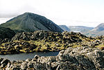
Cumbria is well-known for its natural beauty and much of its landscape is protected; the county contains the Lake District National Park and Solway Coast AONB, and parts of the Yorkshire Dales National Park, Arnside and Silverdale AONB, and North Pennines AONB. Together these protect the county's mountains, lakes, and coastline, including Scafell Pike, at 3,209 feet (978 m) England's highest mountain, and Windermere, its largest lake by volume.
The county contains several Neolithic monuments, such as Mayburgh Henge. The region was on the border of Roman Britain, and Hadrian's Wall runs through the north of the county. In the Early Middle Ages parts of the region successively belonged to Rheged, Northumbria, and Strathclyde, and there was also a Viking presence. It became the border between England and Scotland, and was unsettled until the Union of the Crowns in 1603. During the Industrial Revolution mining took place on the Cumberland coalfield and Barrow-in-Furness became a shipbuilding centre, but the county was not heavily industrialised and the Lake District became valued for its sublime and picturesque qualities, notably by the Lake Poets.


