place

South Park, Santa Rosa, California

Chicano and Mexican neighborhoods in CaliforniaNeighborhoods in Santa Rosa, California
SouthParkSantaRosaMural

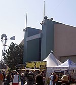
South Park is residential neighborhood in the city of Santa Rosa, California. It is located in south Santa Rosa, east of U.S. Highway 101, south of Bennett Valley Road, west of the Sonoma County Fairgrounds, and encompasses 60 blocks. The community is known for its old houses and artistic murals in the area, and notorious for its history of an above average crime rate and gang activity. South Park was also once a settlement for African Americans during the mid-1900s and was a center of Santa Rosa's Black community. Today, the neighborhood is mainly Latino. It has around 1,500 residents.

Excerpt from the Wikipedia article South Park, Santa Rosa, California (License: CC BY-SA 3.0, Authors, Images).

South Park, Santa Rosa, California
Pressley Street, Santa Rosa

Geographical coordinates (GPS) Address Nearby Places
placeShow on map

Wikipedia: South Park, Santa Rosa, CaliforniaContinue reading on Wikipedia

Geographical coordinates (GPS)

Latitude Longitude
N 38.4284 ° E -122.708 °
placeShow on map

Address

Pressley Street 726
95404 Santa Rosa
California, United States
mapOpen on Google Maps

SouthParkSantaRosaMural
Share experience

Nearby Places

Church of One Tree
Church of One Tree

The Church of One Tree is a historic building in the city of Santa Rosa, California, United States. It was built in 1873/4 from a single redwood tree milled in Guerneville, California. Guerneville was the site of an ancient coastal redwood forest, much of which was logged for the rebuilding of San Francisco after the 1906 earthquake and fire. Prior to being renamed for one of the local milling families, Guerneville was called Stumptown for the giant redwood stumps left by the loggers. The tree used to construct the church stood 275 feet (84 m) high and was 18 feet (5.5 m) in diameter. The single tree, when milled, produced 78,000 board feet (180 m3) of lumber, with the lumber costing a total of $3,000. The church was the original home of the First Baptist Church of Santa Rosa, located in downtown on B Street. It was moved to its current location to avoid destruction.In recent decades, the building has been used for several other unique purposes. Robert Ripley, a native of Santa Rosa, wrote about the Church of One Tree – where his mother attended services – in one of his earliest installments of “Believe It or Not!” In 1970, the Church of One Tree was repurposed as the Ripley Memorial Museum which was stocked with curiosities and “Believe it or Not!” memorabilia for nearly two decades. From the 1950s until 1998 it was the Ripley Memorial Museum. Starting in 2008 and continuing through 2009, the City of Santa Rosa utilized grant funding to re-lead the stained glass windows, as well as repair, paint and renovate the interior of the church, and the Recreation and Parks Department rents out the space for events. It is located adjacent to Juilliard Park and less than one block from the Luther Burbank Home and Gardens historic site.

Doyle Community Park

Doyle Community Park is an urban park on the eastern edge of downtown Santa Rosa, California. The western end of the park is the confluence of Matanzas Creek and Spring Creek. Spring Creek forms the northern park boundary and Matanzas Creek forms the southern park boundary. The eastern end of the park is a fenced and lighted baseball field formerly used by the minor league Santa Rosa Pirates. The remainder of the park includes the Doyle Park Clubhouse, restrooms, playground slides and swings, horseshoe pits, separate fenced areas for unleashed large and small dogs, and picnic tables with barbecue grills including five sites available for reservation.A paved trail follows the shaded riparian woodland of mature oaks, maples, and California bay laurel trees along Spring Creek and Matanzas Creek from the Doyle Park Clubhouse on Hoen Avenue to the footbridge over Matanzas Creek across Vallejo Street from Brook Hill School. Prior to European settlement, what is now Doyle Park was part of a larger riparian wetland within which these creeks changed course when dead trees fell into their channels and accumulated coarse woody debris diverted flood runoff out of those channels to form new channels. Europeans deepened the present creek channels about 4 m (13 ft) through Quaternary alluvium of the Santa Rosa Plain to minimize urban flooding. The park and paved trail is at the level of the original wetland, but there are a few access points into the lower channels which now confine the creeks.Western gray squirrels are plentiful in the park, and a murder of crows often gather nearby. Birdwatchers have observed sparrows, finches, towhees, jays, woodpeckers, robins, bluebirds, mockingbirds, chickadees, phoebes, kinglets, warblers, nuthatches, and titmice.