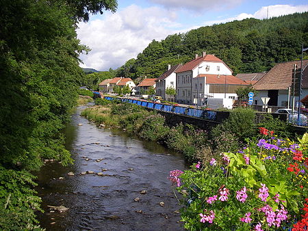
Doller (river)
France river stubsHaut-Rhin geography stubsPages with French IPARivers of FranceRivers of Grand Est ... and 2 more
Rivers of Haut-RhinTributaries of the Ill (France)

The Doller (French pronunciation: [dɔlɛʁ]) is a river in Alsace (Haut-Rhin), in north-eastern France. It is a left tributary of the Ill (a tributary of the Rhine), in Mulhouse. It is 46.5 km (28.9 mi) long.The source of the Doller is in the Vosges Mountains, east of the Ballon d'Alsace, at 940 metres (3,080 ft) elevation. It flows generally east, through the towns Sewen, Dolleren, Masevaux, Sentheim, Reiningue, before it enters the Ill in Mulhouse.
Excerpt from the Wikipedia article Doller (river) (License: CC BY-SA 3.0, Authors, Images).Doller (river)
La Comtoise, Mulhouse Bourtzwiller
Geographical coordinates (GPS) Address Nearby Places Show on map
Geographical coordinates (GPS)
| Latitude | Longitude |
|---|---|
| N 47.765555555556 ° | E 7.3308333333333 ° |
Address
La Comtoise
68100 Mulhouse, Bourtzwiller
Grand Est, France
Open on Google Maps


