Wessington
Civil parishes in DerbyshireDerbyshire geography stubsNorth East Derbyshire DistrictTowns and villages of the Peak DistrictVillages in Derbyshire

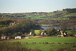
Wessington is a village and civil parish in the English county of Derbyshire. The population of the civil parish at the 2011 census was 576. It is in the North East Derbyshire district of the county. It is near to the towns of Matlock, Alfreton and the village of Brackenfield. Situated 740 ft above sea level. The civil parish of Wessington is, along with Shirland and Higham, the most southerly parish in the district. It stands on the west side of the Amber Valley on the Alfreton to Matlock Road. The settlement is centered on a large village green, a fish and chip shop and an old pub, "The Horse and Jockey".
Excerpt from the Wikipedia article Wessington (License: CC BY-SA 3.0, Authors, Images).Wessington
The Greendale, North East Derbyshire
Geographical coordinates (GPS) Address Nearby Places Show on map
Geographical coordinates (GPS)
| Latitude | Longitude |
|---|---|
| N 53.1165 ° | E -1.4479 ° |
Address
The Greendale
DE55 6EZ North East Derbyshire
England, United Kingdom
Open on Google Maps


