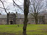
Whitle
Derbyshire geography stubsHamlets in DerbyshireNew MillsTowns and villages of the Peak District

Whitle is a historic hamlet in Derbyshire. The Whitle area is now part of the town of New Mills, and lies between the centre of the town and the hamlet of Thornsett. The main approach to the hamlet is via an unadopted road from the south, connecting with Apple Tree Road. This continues north-east as a public bridleway and private driveway to Mellor Road. Public footpaths lead north-west and WSW across New Mills Golf Course, which is immediately west of the hamlet.
Excerpt from the Wikipedia article Whitle (License: CC BY-SA 3.0, Authors, Images).Whitle
Whitle Bank Road, High Peak Low Leighton
Geographical coordinates (GPS) Address Nearby Places Show on map
Geographical coordinates (GPS)
| Latitude | Longitude |
|---|---|
| N 53.377771 ° | E -2.002675 ° |
Address
Whitle Bank Road
SK22 4EF High Peak, Low Leighton
England, United Kingdom
Open on Google Maps


