place

1996 Maryland train collision

1996 disasters in the United States1996 in MarylandAccidents and incidents involving AmtrakAccidents and incidents involving CSX TransportationAccidents and incidents involving MARC Train
Brunswick LineFebruary 1996 events in the United StatesRailway accidents and incidents in MarylandRailway accidents in 1996Railway accidents involving a signal passed at dangerSilver Spring, Maryland (CDP)Train collisions in the United StatesUse mdy dates from February 2018
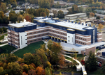
Silver Spring collision aerial

On February 16, 1996, a MARC commuter train collided with Amtrak's Capitol Limited passenger train in Silver Spring, Maryland, United States, killing three crew and eight passengers on the MARC train; a further eleven passengers on the same train and fifteen passengers and crew on the Capitol Limited were injured. Total damage was estimated at $7.5 million. An investigation by the National Transportation Safety Board (NTSB) found that the crew of the MARC train had forgotten the indication of an approach signal which they had passed before a station stop, and as a consequence, could not slow down in time after encountering a stop signal. The crash led to the creation of comprehensive federal rules for passenger car design, the first in the history of passenger service in the U.S., as well as changes to operating rules.

Excerpt from the Wikipedia article 1996 Maryland train collision (License: CC BY-SA 3.0, Authors, Images).

1996 Maryland train collision
Capital Crescent Trail, Silver Spring Montgomery Hills

Geographical coordinates (GPS) Address Nearby Places
placeShow on map

Wikipedia: 1996 Maryland train collisionContinue reading on Wikipedia

Geographical coordinates (GPS)

Latitude Longitude
N 39.0008 ° E -77.0423 °
placeShow on map

Address

Capital Crescent Trail

Capital Crescent Trail
20910 Silver Spring, Montgomery Hills
Maryland, United States
mapOpen on Google Maps

Silver Spring collision aerial
Share experience

Nearby Places

North Portal Estates

North Portal Estates is an affluent residential neighborhood in Washington, D.C. that forms the northernmost corner of the District of Columbia. North Portal Estates is bounded by North Portal Drive to the south, East Beach Drive to the west and northwest, and Rock Creek Park to the northeast. It is not set on any major thoroughfare in the city, although North Portal Drive is accessible via a rotary intersection on 16th Street NW. Because of its isolation via the park and lack of major streets, the neighborhood is extraordinarily suburban in character, full of winding streets, detached houses on large lots, and open space. North Portal Estates and the rest of Ward 4 are represented in the Council of the District of Columbia by Janeese Lewis George. The community was mostly Jewish, in contrast to the nearby Colonial Village, which was a mostly Protestant neighborhood. The community was constructed by wealthy Jewish families in the 1950s and 1960s, following the 1948 Supreme Court decision striking down racially restrictive covenants. The homes in North Portal Estates are larger and more recent than the older homes in Shepherd Park. Racial covenants were prohibited by law by the 1968 Fair Housing Act. African-Americans began moving into North Portal Estates in the late 1960s and early 1970s, comprising two-thirds of the population by the 1980s as the older Jewish population began to move away or die. By the early 1980s, North Portal Estates had become a premier neighborhood for upper-middle-class African-American professionals in Washington, D.C., including doctors, lawyers, business people, clergy, and politicians. While mostly black, the neighborhood is multiracial as some white Jewish families have remained in the neighborhood. By the 2010s, the neighborhood was still predominantly upscale, but had become home to a more socioeconomically and racially mixed population.