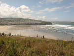
River Camel

The River Camel (Cornish: Dowr Kammel, meaning crooked river) is a river in Cornwall, England. It rises on the edge of Bodmin Moor and with its tributaries its catchment area covers much of North Cornwall. The river flows into the eastern Celtic Sea between Stepper Point and Pentire Point having covered about 30 miles, making it the second longest river wholly in Cornwall. The river is tidal upstream to Egloshayle and is popular for sailing, birdwatching and fishing. The name Camel comes from the Cornish language for 'the crooked one', a reference to its winding course. Historically the river was divided into three named stretches. Heyl (Cornish: Heyl, meaning estuary) was the name for the estuary up to Egloshayle, the River Allen (Cornish: Dowr Alen, meaning shining river) was the stretch between Egloshayle and Trecarne, whilst the Camel was reserved for the stretch of river between its source and Trecarne.
Excerpt from the Wikipedia article River Camel (License: CC BY-SA 3.0, Authors, Images).River Camel
Geographical coordinates (GPS) Address Nearby Places Show on map
Geographical coordinates (GPS)
| Latitude | Longitude |
|---|---|
| N 50.578 ° | E -4.939 ° |
Address
Pentire Point
PL27 6US , St. Minver Highlands
England, United Kingdom
Open on Google Maps


