place

Nigrán

Galicia (Spain) geography stubsMunicipalities in the Province of Pontevedra
Casa do Concello de Nigrán, parte vella

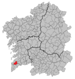
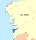
Nigrán is a municipality in the province of Pontevedra, in the autonomous community of Galicia, northwestern Spain. It belongs to the comarca of Vigo and the Vigo metropolitan area. Nigrán has a surface of 35 km2, with a population of approximately 18,000 people divided into seven parishes: Nigrán, Panxón, San Pedro, Parada, Camos, Chandebrito and Priegue. Nigran's population practically triples in the summer months. It is on the Atlantic coast of Spain and is considered a summer destination for tourists due to its beaches and mild summer weather.

Excerpt from the Wikipedia article Nigrán (License: CC BY-SA 3.0, Authors, Images).

Geographical coordinates (GPS)

Latitude Longitude
N 42.141944444444 ° E -8.8055555555556 °
placeShow on map

Address


36350 Nigrán
Galicia, Spain
mapOpen on Google Maps

Casa do Concello de Nigrán, parte vella
Share experience

Nearby Places

Castro fortress
Castro fortress

The Fortress of El Castro is a fortification located in Vigo, Spain built in 1665 by the Spanish Empire in the province of Pontevedra during the Portuguese Restoration War to defend the region from potential attacks by English forces.Built on a hill of the same name, the defensive system of Vigo consisted of the fortresses of O Castro and San Sebastián along with the city wall. The city wall had an irregular shape due to the orography of the city, and was constructed by two Spanish Army officers: Colonel Fernando de Gourannanbergue and Maestre de campo Diego Arias Taboada to link the two fortresses together. Despite this effort to provide security to the city, documents from that time say that this defensive system was ineffective as it could not impede landings further along the coast. During the War of the Spanish Succession, the fortress saw action during the Battle of Vigo Bay on 23–24 October 1702, when a combined English Royal Navy and Dutch States Navy fleet attacked elements of the French and Spanish navies, defeating them. The fortress, along with the city of Vigo itself, were captured by British forces as part of the capture of Vigo and Pontevedra during the War of the Quadruple Alliance on 10 October 1719. In 1809, the fortress was occupied by the French Imperial Army during Peninsular War; on 28 March of that year, the fortress was reconquered by Spanish forces following an uprising by people of Vigo; as a result, the city was given the honorific title of "the faithful, loyal and courageous city of Vigo" the following year. Nowadays the fortress is one of the preferred sites for people to take a walk in Vigo, because his beautiful gardens, open spaces, fonts and also the privileged views.

Ria de Vigo
Ria de Vigo

Vigo Ria (Spanish: Ría de Vigo) and (Galician: Ría de Vigo) is an estuary in Galicia, Spain. It is the southernmost ria of the Rías Baixas. It is located south of the province of Pontevedra, and extends in a northeast direction over a distance of 35 kilometres (22 mi) from its mouth at Cape Silleiro to the deepest point in Arcade, with a maximum width of 7 km (4.3 mi) and the narrowest in the Strait of Rande, at 700 m (2,300 ft). Its western entrance is protected by the Cies Islands, which are part of the National Park of the Atlantic Islands which is within the islands of Toralla and San Simon. It borders to the north with the Morrazo Peninsula. In the extreme south lies the Bay of Baiona. Its easy access, depth and calm waters make the Vigo estuary an ideal retreat for sailing and water sports.From the environmental point of view, it is a bay with a biological richness due to its water currents and deep cold waters from the north, carrying large quantities of nutrients. Historically, the Vigo estuary area has been good for fishing and shell fishing, although current conditions are not ideal due to high human and industrial activity on the coastal waterfront.On its banks stands the city of Vigo. The municipalities of Baiona, Nigrán, Redondela, Soutomaior, Vilaboa, Moaña and Cangas do Morrazo are also situated here. It has a total population of about 420,000 inhabitants. The Battle of Rande was fought here on October 23, 1702, more precisely at the end of the estuary, in the Ensenada de San Simón. In 1943, the following German U-boats are reported to have been sunk somewhere in the ria: German submarine U-523, sunk 25 August 1943 (17 dead and 37 survivors), and U-506, sunk at 15:50 on 12 July 1943 (48 dead and six survivors).