place

History of Halifax (former city)

Commons category link is locally definedConflicts in Nova ScotiaHistory of Halifax, Nova ScotiaHistory of Nova ScotiaHistory of Nova Scotia by location
Military history of Nova ScotiaPages with non-numeric formatnum argumentsPopulated places disestablished in 1996Populated places established in 1749Vague or ambiguous time from July 2015
Halifax Town Clock
Halifax Town Clock

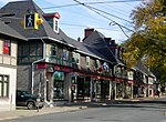
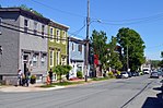
Halifax, Nova Scotia, was originally inhabited by the Miꞌkmaq. The first European settlers to arrive in the future Halifax region were French, in the early 1600s, establishing the colony of Acadia. The British settled Halifax in 1749, which sparked Father Le Loutre's War. To guard against Miꞌkmaw, Acadian, and French attacks on the new Protestant settlements, British fortifications were erected in Halifax (Citadel Hill) (1749), Bedford (Fort Sackville) (1749), Dartmouth (1750), and Lawrencetown (1754). St. Margaret's Bay was first settled by French-speaking Foreign Protestants at French Village, Nova Scotia, who migrated from Lunenburg, Nova Scotia, during the American Revolution. All of these regions were amalgamated into the Halifax Regional Municipality (HRM) in 1996. While all of the regions of HRM developed separately over the last 250 years, their histories have also been intertwined. The City of Halifax was an incorporated city in Nova Scotia, Canada, which was established as the Town of Halifax in 1749, and incorporated as a city in 1842. On April 1, 1996, the government of Nova Scotia dissolved the City of Halifax, and amalgamated the four municipalities within Halifax County and formed Halifax Regional Municipality, a single-tier regional government covering that whole area. The city was the capital of Nova Scotia and shire town of Halifax County. It was then also the largest city in Atlantic Canada.The Town of Halifax was founded by the Kingdom of Great Britain under the direction of the Board of Trade under the command of Governor Edward Cornwallis in 1749. The British founding of Halifax and the influx of British Protestant settlers led to Father Le Loutre's War. During the war, Miꞌkmaq and Acadians raided the capital region 13 times. Halifax was founded below a drumlin that would later be named Citadel Hill. The outpost was named in honour of George Montague-Dunk, 2nd Earl of Halifax, who was the President of the Board of Trade. Halifax was ideal for a military base, with the vast Halifax Harbour, among the largest natural harbours in the world, which could be well protected with artillery battery at McNab's Island, the Northwest Arm, Point Pleasant, George's Island and York Redoubt. In its early years, Citadel Hill was used as a command and observation post, before changes in artillery that could range out into the harbour. After a protracted struggle between residents and the Viceroys of Nova Scotia, the City of Halifax was incorporated in 1842. Since the creation of HRM in 1996, the area of the former City of Halifax is referred to as an unincorporated "provincial community" by the provincial government's place name website and the civic addressing office of HRM, the area is referred to as "Halifax, Nova Scotia" for civic addressing and as a placename. The area is administered as two separate community planning areas by the regional government for development, Halifax Peninsula and Mainland Halifax. It forms a significant part of the Halifax urban area. Residents of the former city are called "Haligonians".

Excerpt from the Wikipedia article History of Halifax (former city) (License: CC BY-SA 3.0, Authors, Images).

History of Halifax (former city)
Novalea Drive, Halifax

Geographical coordinates (GPS) Address Nearby Places
placeShow on map

Wikipedia: History of Halifax (former city)Continue reading on Wikipedia

Geographical coordinates (GPS)

Latitude Longitude
N 44.67 ° E -63.61 °
placeShow on map

Address

Novalea Drive 3688
B3K 3G2 Halifax
Nova Scotia, Canada
mapOpen on Google Maps

Halifax Town Clock
Halifax Town Clock
Share experience

Nearby Places

Africville
Africville

Africville was a small community of predominantly Black Canadians located in Halifax, Nova Scotia, Canada. It developed on the southern shore of Bedford Basin and existed from the early 1800s to the 1960s. From 1970 to the present, a protest has occupied space on the grounds. The government has recognized it as a commemorative site and established a museum here. The community has become an important symbol of killing identity, as an example of the "urban renewal" trend of the 1960s that razed similarly racialized neighbourhoods across Canada, and the struggle against racism. Africville was founded by Black Nova Scotians from a variety of origins. Many of the first settlers were formerly enslaved African Americans from the Thirteen Colonies, Black Loyalists who were freed by the Crown during the American Revolutionary War and War of 1812. (Black people settled in Africville along Albemarle Street, where they had a school established in 1785 that served the Black community for decades under Rev. Charles Inglis.) Other residents arrived later, in association with Black people being recruited from the American South for jobs in mining at Glace Bay. During the 20th century, Halifax neglected the community, failing to provide basic infrastructure and services such as roads, water, and sewerage. The city continued to use the area as an industrial site, notably introducing a waste-treatment facility nearby in 1958. The residents of Africville struggled with poverty and poor health conditions as a result, and the community's buildings became badly deteriorated. During the late 1960s, the City of Halifax condemned the area, relocating its residents to newer housing in order to develop the nearby A. Murray MacKay Bridge, related highway construction, and the Port of Halifax facilities at Fairview Cove to the west. Soon after this, former residents and activists began a long protest on the site against their treatment and the condemnation. In 1996 the site was designated as a National Historic Site of Canada as being representative of Black Canadian settlements in the province and as an enduring symbol of the need for vigilance in defence of their communities and institutions. After years of protest and investigations, in 2010 the Halifax Council ratified a proposed "Africville Apology", under an arrangement with the federal government, to compensate descendants and their families who had been evicted from the area. In addition, an Africville Heritage Trust was established to design a museum and build a replica of the community church.

Halifax Needham
Halifax Needham

Halifax Needham is a provincial electoral district in Halifax, Nova Scotia, Canada, that elects one member of the Nova Scotia House of Assembly. It has existed since 1967, though its boundaries have changed periodically. Halifax Needham encompasses what is largely known as the North End of Halifax. It has been held by members of each of the three major political parties in Nova Scotia at different times. The riding was once the home of Liberal Premier Gerald Regan before going to Progressive Conservative Edmund L. Morris for the majority of the 1980s. Morris served as a Member of Parliament for Halifax under Progressive Conservative Prime Minister John Diefenbaker before becoming the Mayor of Halifax. He served in the Provincial Cabinet as Minister of Intergovernmental Affairs, Municipal Affairs, Fisheries, and Social Services. When he stepped down in 1988, the Progressive Conservatives lost the seat in that election to Gerry O'Malley, who was unseated from his position as Liberal Minister of Supply and Services in 1998. Maureen MacDonald held the seat from 1998 until 2016. The seat is considered a reasonably safe seat for the NDP, though the 2013 election was close, amid a province-wide swing to the Liberals. It was created in 1966 when Halifax North was divided into three districts, one of which was Halifax City North East. The district was renamed Halifax Needham in 1967. In 2003, it gained an area east of Citadel Hill from Halifax Citadel. In 2013, it lost the area south of Robie Street and east of Young Street to Halifax Chebucto and gained the area north of Bayers Road and east of Connaught Avenue from Halifax Chebucto.