place

Reisterstown Station, Baltimore

Neighborhoods in BaltimoreReisterstown Station, Baltimore
North side of Reisterstown Road Plaza

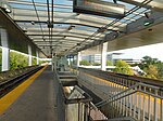
Reisterstown Station is a neighborhood in the Northwest District of Baltimore, located between the neighborhoods of Glen (northeast) and Grove Park (southwest). The Baltimore County line is the neighborhood's western border. Its other boundaries are drawn by Reisterstown Road (northeast), West Northern Parkway (southeast), Crest Heights Road (northwest), Patterson Avenue and Wabash Avenue (southwest).Fallstaff Shopping Center is located in the northern corner of Reisterstown Station. Reisterstown Road Plaza, also known as The Plaza, is a mall located to the south of the smaller shopping center, along Reisterstown Road.The Reisterstown Plaza Metro station, on Wabash Avenue near its intersection with Patterson Avenue, gives neighborhood residents quick access to Downtown Baltimore and Johns Hopkins Hospital or Owings Mills, Maryland.Other MTA facilities on Wabash Avenue within the Reisterstown Station neighborhood include the Metro Operations, Systems Maintenance, Transportation & Maintenance and Railcar Maintenance offices and shops. These facilities maintain a rail yard along Wabash Avenue with 15 tracks, two maintenance shop buildings and a yard tower.

Excerpt from the Wikipedia article Reisterstown Station, Baltimore (License: CC BY-SA 3.0, Authors, Images).

Reisterstown Station, Baltimore
Patterson Avenue, Baltimore

Geographical coordinates (GPS) Address Nearby Places
placeShow on map

Wikipedia: Reisterstown Station, BaltimoreContinue reading on Wikipedia

Geographical coordinates (GPS)

Latitude Longitude
N 39.354 ° E -76.7054 °
placeShow on map

Address

Patterson Avenue
21215 Baltimore
Maryland, United States
mapOpen on Google Maps

North side of Reisterstown Road Plaza
Share experience

Nearby Places

Wabash Avenue (Baltimore, Maryland)

Wabash Avenue is a six-lane boulevard in northwest Baltimore, Maryland, that runs from Patterson Avenue to Hilton Street, mostly through the Arlington community, crossing over Northern Parkway and Cold Spring Lane along the way. The road starts near the Reisterstown Plaza Metro Subway Station and continues to just past the West Coldspring Metro Subway Station, where it narrows and becomes a one-way pair with Dorithan Road, which ends several blocks later at Hilton Street. Wabash Avenue actually begins as a stub near the Reisterstown Road Plaza. The stub exists where a longer road was intended as part of the original plans of Interstate 795. This portion of I-795, which would have run through historic Sudbrook Park before reaching the city, was fought and ultimately cancelled as a result of complaints from Sudbrook Park residents. This led to the cancellation of all parts of I-795 within the city, and its truncation to I-695 (the Baltimore Beltway) near the suburb of Pikesville. Still, the road was constructed as a Boulevard, and the Metro Subway was constructed along an overhead track directly parallel to the road. Three stations of the Metro system (Reisterstown Plaza, Rogers Avenue and West Coldspring) are located along Wabash Avenue. A second street, which also carries the Wabash Avenue name, branches north off Liberty Heights Avenue near Mondawmin Mall before coming to a dead end at an apartment complex situated near the Metro tracks south of the West Coldspring Station; it does not connect to the other Wabash Avenue. South of Liberty Heights Avenue, the road continues as Dukeland Street. A third street that carries the Wabash Avenue name is located in the suburb of Reisterstown, Maryland, and acts as a connector between Butler Road (MD 128) and Chatsworth Avenue, coming to a dead end beyond the latter road.