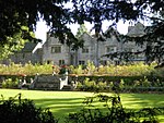
Derbyshire Dales
Derbyshire DalesNon-metropolitan districts of Derbyshire

Derbyshire Dales ( DAR-bee-sheer, -shər) is a local government district in Derbyshire, England. The district was created in 1974 as West Derbyshire; the name was changed to Derbyshire Dales in 1987. The council is based in the town of Matlock, and the district also includes the towns of Ashbourne, Bakewell, Darley Dale and Wirksworth, as well as numerous villages and extensive rural areas. Much of the district is within the Peak District National Park. The neighbouring districts are High Peak, Sheffield, North East Derbyshire, Amber Valley, South Derbyshire, East Staffordshire and Staffordshire Moorlands.
Excerpt from the Wikipedia article Derbyshire Dales (License: CC BY-SA 3.0, Authors, Images).Derbyshire Dales
Wood Lane, Derbyshire Dales
Geographical coordinates (GPS) Address Nearby Places Show on map
Geographical coordinates (GPS)
| Latitude | Longitude |
|---|---|
| N 53.05 ° | E -1.7 ° |
Address
Wood Lane
Wood Lane
DE6 1JG Derbyshire Dales
England, United Kingdom
Open on Google Maps


