place

Angel Island (California)

1962 establishments in CaliforniaAmerican Civil War army postsCalifornia Historical LandmarksCampgrounds in CaliforniaForts in California
Government buildings on the National Register of Historic Places in CaliforniaHistory of Marin County, CaliforniaIsland restorationIslands of Marin County, CaliforniaIslands of Northern CaliforniaIslands of San Francisco BayNational Register of Historic Places in Marin County, CaliforniaParks in Marin County, CaliforniaProtected areas established in 1962State parks of CaliforniaTemporary populated places on the National Register of Historic PlacesWorld War II prisoner-of-war camps in the United States
Angel Island (California)

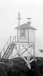
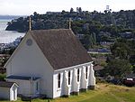
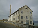
Angel Island is an island in San Francisco Bay. The entire island is included within Angel Island State Park, administered by California State Parks. The island, a California Historical Landmark, has been used by humans for a variety of purposes, including seasonal hunting and gathering by indigenous peoples, water and timber supply for European ships, ranching by Mexicans, United States military installations, a United States Public Health Service Quarantine Station, and a U.S. Bureau of Immigration inspection and detention facility. The Angel Island Immigration Station, on the northeast corner of the island, which has been designated a National Historic Landmark, was where officials detained, inspected, and examined approximately one million immigrants, who primarily came from Asia. Under the Chinese Exclusion Act of 1882, the first United States law to restrict a group of immigrants based on their race, nationality, and class, all arriving Chinese immigrants were to be examined by immigration or customs agents.

Excerpt from the Wikipedia article Angel Island (California) (License: CC BY-SA 3.0, Authors, Images).

Angel Island (California)
Sunset Trail,

Geographical coordinates (GPS) Address Nearby Places
placeShow on map

Wikipedia: Angel Island (California)Continue reading on Wikipedia

Geographical coordinates (GPS)

Latitude Longitude
N 37.86 ° E -122.43 °
placeShow on map

Address

Sunset Trail

Sunset Trail
94920
California, United States
mapOpen on Google Maps

Angel Island (California)
Share experience

Nearby Places

Tiburon, California
Tiburon, California

Tiburon (; Spanish: Tiburón, [tiβuˈɾon]) is an incorporated town in Marin County, California. It is located on the Tiburon Peninsula, which reaches south into the San Francisco Bay. It shares a ZIP code (94920) with the smaller incorporated city of Belvedere (formerly a separate island), which occupies the southwest part of the peninsula and is contiguous with Tiburon. Tiburon is bordered by Corte Madera to the north and Mill Valley to the west, but is otherwise mostly surrounded by the bay. Besides Belvedere and Tiburon, much of the peninsula is unincorporated, including portions of the north side and the communities of Strawberry and Paradise Cay. The population of Tiburon was 9,146 at the 2020 census and has 6,600 registered voters. Belvedere and Tiburon share a post office, library and recreation agency.The city's name derives from the Spanish word tiburón, which means "shark". The name was first given to the peninsula on which the city is situated, and probably inspired by the prevalence of locally native leopard sharks in the surrounding waters. Tiburon was formerly the southern terminus of the San Francisco and North Pacific Railroad (subsequently the Northwestern Pacific Railroad), which transported freight for transfer to barges for shipping to cities around San Francisco Bay. It is now a commuter and tourist town, linked by fast ferry services to San Francisco and with a concentration of restaurants and clothes shops. It is the nearest mainland point to Angel Island and a regular ferry service connects to the island.