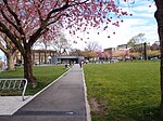
Strathcona, Vancouver

Strathcona is the oldest residential neighbourhood of Vancouver, British Columbia, Canada. Officially a part of the East Side, it is bordered by Downtown Vancouver's Chinatown neighbourhood and the False Creek inlet (across Main Street) to the west, Downtown Eastside (across Hastings Street) to the north, Grandview-Woodland (across Clark Drive) to the east, and Mount Pleasant to the south of Emily Carr University and the Canadian National Railway and Great Northern Railway (now BNSF Railway) classification yards. By some definitions, Strathcona's northern border is the roads just south of Burrard Inlet, and much of the Downtown Eastside lies within Strathcona. By other definitions, Strathcona's northern boundary is just south of Hastings Street, and the Downtown Eastside is a separate neighbourhood to the north and northwest of Strathcona. The modern official demarcation puts Strathcona's northern border at Keefer Street.Strathcona has long been a hub of immigration and culture relative to Vancouver's more recently settled neighbourhoods. Chinese immigrants, Vietnamese immigrants, and various groups of European immigrants have characterized the neighbourhood's culture. Although Strathcona was historically a working-class neighbourhood, recently, more middle-class and affluent groups have come to inhabit the neighbourhood, attracted by its vibrant community. Strathcona is home to many art galleries, family-owned corner stores, and other small businesses.
Excerpt from the Wikipedia article Strathcona, Vancouver (License: CC BY-SA 3.0, Authors, Images).Strathcona, Vancouver
Keefer Street, Vancouver Strathcona
Geographical coordinates (GPS) Address Nearby Places Show on map
Geographical coordinates (GPS)
| Latitude | Longitude |
|---|---|
| N 49.279166666667 ° | E -123.0875 ° |
Address
Keefer & Hawks
Keefer Street
V6A Vancouver, Strathcona
British Columbia, Canada
Open on Google Maps


