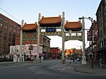
Hogan's Alley, Vancouver

Hogan's Alley was the local, unofficial name for Park Lane, an alley that ran through the southwestern corner of Strathcona in Vancouver, British Columbia. The alley was located between Union and Prior (North-South) and ran from approximately Main Street to Jackson Avenue (West-East). The area was ethnically diverse, populated by Black, Italian, Chinese, Japanese, Jewish, and Indigenous residents during the first six decades of the twentieth century. Home to a number of Black families, Black businesses, and the city's only Black church (the African Methodist Episcopal Fountain Chapel), Hogan's Alley has been referred to as the "first and last neighbourhood in Vancouver with a substantial concentrated black population". Hogan's Alley had a vibrant night life, with eateries and nightclubs that hosted local residents, railway porters, and touring musicians alike.Most of Hogan's Alley was destroyed circa 1970 by the Non-Partisan Association civic government's construction of the Georgia Viaduct, the first phase of a planned interurban freeway originally set to run through Hogan's Alley and much of Chinatown and Gastown. The subsequent freeway construction was stopped by the Strathcona Property Owners and Tenants Association, and Strathcona, Chinatown and Gastown were spared from razing, but not before Hogan's Alley was mostly demolished and the viaducts were built. The area where Hogan's Alley once was currently bears little mark of the Black community's historical presence. Since its destruction, Hogan's Alley has been referenced in several community-based cultural works and city projects. Groups such as Hogan's Alley Memorial Project, the Hogan's Alley Working Group, and the Hogan's Alley Society have worked to memorialize the area and advocate for Vancouver's Black community. In 2015, the City of Vancouver announced its plans to remove the viaducts and establish a cultural centre in the Hogan's Alley area.
Excerpt from the Wikipedia article Hogan's Alley, Vancouver (License: CC BY-SA 3.0, Authors, Images).Hogan's Alley, Vancouver
Dunsmuir Viaduct, Vancouver
Geographical coordinates (GPS) Address Nearby Places Show on map
Geographical coordinates (GPS)
| Latitude | Longitude |
|---|---|
| N 49.2772 ° | E -123.0973 ° |
Address
Dunsmuir Viaduct
Dunsmuir Viaduct
V6A Vancouver
British Columbia, Canada
Open on Google Maps


