place

Copplestone

Former manors in DevonVillages in Devon
Copplestone geograph.org.uk 1393573

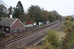
Copplestone (anciently Copelaston, Coplestone etc.) is a village, former manor and civil parish in Mid Devon in the English county of Devon. It is not an ecclesiastical parish as it has no church of its own, which reflects its status as a relatively recent settlement which grew up around the ancient "Copleston Cross" (see below) that stands at the junction of the three ancient ecclesiastical parishes of Colebrooke, Crediton and Down St Mary.The small parish is surrounded clockwise from the north by the parishes of Sandford, Crediton Hamlets, Colebrooke, Clannaborough, and Down St Mary. According to the 2001 census the parish had a population of 894, increasing to 1,253 in 2011. It is situated right in the middle of Devon halfway between Exeter and Barnstaple on the A377, nestled in a valley. Copplestone is a major part of the Yeo electoral ward whose total ward population was 3,488 at the above census.The Tarka Line railway goes through the middle of the village and calls at Copplestone railway station. Copplestone is surrounded by hills and is not far from Dartmoor, visible to the east and Exmoor to the north, a little farther away. The surrounding countryside has been used for agriculture from before Roman occupation of the area.

Excerpt from the Wikipedia article Copplestone (License: CC BY-SA 3.0, Authors, Images).

Copplestone
Back Lane, Mid Devon Colebrooke

Geographical coordinates (GPS) Address Nearby Places
placeShow on map

Wikipedia: CopplestoneContinue reading on Wikipedia

Geographical coordinates (GPS)

Latitude Longitude
N 50.8 ° E -3.75 °
placeShow on map

Address

Back Lane

Back Lane
EX17 5DD Mid Devon, Colebrooke
England, United Kingdom
mapOpen on Google Maps

Copplestone geograph.org.uk 1393573
Share experience

Nearby Places

River Yeo (tributary of the Creedy)

The River Yeo is a tributary to the River Creedy. It is located in Devon, England, and its headwaters float within two miles of a different River Yeo, which is a tributary to River Taw. It is a popular location for fly fishing, with the Crediton Fly Fishing Club owning a small portion of it.Tributaries of the River Yeo include River Culvery which joins just south of Crediton, Ford Brook which joins at Neopardy, and River Troney which joins at Yeoford. The source of the river is near Merrymeet Junction on the A30 Road at Whiddon Down. Since January 1997, a flood gauge at Yeoford measures the river height, which is normally below 0.66 metres (2 ft 2 in). The site base level is 60.58 metres (198.8 ft) The highest recorded level is 2.69 metres (8 ft 10 in) on 25 November 2012.South of Crediton the River Yeo forms part of the boundary between Crediton Civil Parish and Crediton Hamlets Civil Parish. Southwest of Yeoford the River Yeo forms the boundary between Colebrook Civil Parish and Crediton Hamlets Civil Parish. Further to the southwest it forms the boundary between Hittisleigh CP and Cheriton Bishop CP.Places along the river include Downs Crediton Golf Club, Fordton Mill, Salmonhutch, Salmonhutch Caravan Park, Beare Mill, Neopardy, Yeoford, Martin's Moor Copse, Wotton's Moor Copse, Binneford, Binneford Wood, Parlepit Copse, Furzeyew Copse, Vennals Copse, Milball Copse, Ball Copse, and Treable Woods.