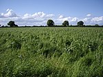
Little Heath, Cheshire East
Cheshire geography stubsVillages in Cheshire

Little Heath is a village in the civil parish of Audlem, Cheshire, England. It is located to the north of Audlem, between Lonk Land and Audlem Road, the latter being part of today's A529 road.
Excerpt from the Wikipedia article Little Heath, Cheshire East (License: CC BY-SA 3.0, Authors, Images).Little Heath, Cheshire East
Monks Lane,
Geographical coordinates (GPS) Address Nearby Places Show on map
Geographical coordinates (GPS)
| Latitude | Longitude |
|---|---|
| N 52.9965 ° | E -2.49919 ° |
Address
Monks Lane
Monks Lane
CW3 0HP , Audlem
England, United Kingdom
Open on Google Maps


