Toldbodgade
Commons category link is locally definedStreets in Copenhagen

Toldbodgade (lit. "Custom House Street") is a street in central Copenhagen, Denmark. It extends north from Nyhavn at the Nyhavn Bridge, continuing Holberggade, passes Sankt Annæ Plads after just one block, and continues straight until it reaches West India Warehouse where it makes a sharp left turn which connects it to Amaliegade, its parallel street, at the rear of the Design Museum. The east side of the street is lined by a series of 18th century warehouses whose other sides face the Larsens Plads waterfront, which was a major hub for emigration to America.
Excerpt from the Wikipedia article Toldbodgade (License: CC BY-SA 3.0, Authors, Images).Toldbodgade
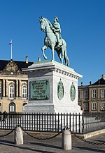
Amalienborg Slotsplads, Copenhagen Christianshavn
Geographical coordinates (GPS) Address Nearby Places Show on map
Geographical coordinates (GPS)
| Latitude | Longitude |
|---|---|
| N 55.6842 ° | E 12.595 ° |
Address
Amalienborg
Amalienborg Slotsplads
1257 Copenhagen, Christianshavn
Capital Region of Denmark, Denmark
Open on Google Maps


