Ilik River Fortification II
1940s establishments in GuamBuildings and structures on the National Register of Historic Places in GuamFortification stubsGuam Registered Historic Place stubsGuamanian building and structure stubs ... and 1 more
World War II on the National Register of Historic Places in Guam
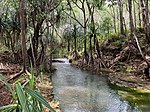
The Ilik River Fortification II near Yona, Guam was built by Japanese forces during World War II. It was listed on the U.S. National Register of Historic Places in 1991. It is a pillbox located about 100 meters from an entrance to Ylig Bay, 30 meters inland from the high tide line, and about 50 meters above sea level. The fortification consists of three partial sides of a structure made of coral pieces cemented together, a construction technique introduced to the island during its colonial Spanish administration. The surviving wall segments range in thickness from 0.7 metres (2.3 ft) to 0.9 metres (3.0 ft) in thickness, and there is a gun port in the south-facing wall.
Excerpt from the Wikipedia article Ilik River Fortification II (License: CC BY-SA 3.0, Authors).Ilik River Fortification II
North Chalan Canton Tasi,
Geographical coordinates (GPS) Address Nearby Places Show on map
 Continue reading on Wikipedia
 Geographical coordinates (GPS)
| Latitude | Longitude |
|---|---|
| N 13.387222222222 ° | E 144.77305555556 ° |
Address
Togcha Cemetery
North Chalan Canton Tasi
Guam, United States
Open on Google Maps