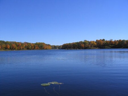
Saunders Lake

Saunders Lake is located in the United States state of Minnesota. It is a 70-acre (280,000 m2) lake that is west-southwest of Minneapolis–St. Paul in the Minneapolis suburbs of Mound and Minnetrista. The first European settlers came to the area near Saunders Lake in the 1850s. In 1854, Nathaniel Sanders and J. F. Buck settled on its shores. Saunders Lake was named for Nathaniel Sanders.[1]. The lake is a large, Type 5 wetland, classified as a Natural Environment lake.[2]. The lake outlets through a small channel to Lake Langdon, which discharges through a culvert under County State-Aid Highway 110 into Lost Lake, which outlets into Cooks Bay of Lake Minnetonka. It is part of the Langdon Lake subwatershed of the Minnehaha Creek Watershed District (MCWD). The corridor between Black (also called Flanagan) and Saunders Lakes consists of wetlands and maple-basswood forest and has been identified by the Minnesota Department of Natural Resources as a regionally significant area with outstanding ecological value. Most of this area has been incorporated into Gale Woods Regional Park by the Three Rivers Park District. Saunders Lake scores highly on vegetative diversity, fish and wildlife habitat, and is classified in the Preserve category. Boating Regulations: Saunders Lake does not have any boating or motor regulations. Here is the DNR list of Metro lakes with boating regulations.
Excerpt from the Wikipedia article Saunders Lake (License: CC BY-SA 3.0, Authors, Images).Saunders Lake
Cherrywood Court,
Geographical coordinates (GPS) Address Nearby Places Show on map
Geographical coordinates (GPS)
| Latitude | Longitude |
|---|---|
| N 44.9295 ° | E -93.6927 ° |
Address
Cherrywood Court
Cherrywood Court
55364
Minnesota, United States
Open on Google Maps


