place

Lake Langdon

Lakes of Hennepin County, MinnesotaLakes of Minnesota
Langdon Bay Shoreline Blue Heron

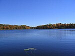
Lake Langdon in Mound, Minnesota, has an area of 144 acres (0.6 km2). Minnehaha Creek Watershed District (MCWD) charts show its maximum depth of 38 feet (12 m), though it would be classified as a shallow lake with a mean depth of 8.3 feet (2.5 m). It is named for R. V. Langdon, the first township clerk. It is located west of Commerce Boulevard and south of Lynwood Boulevard. Boats on the lake cannot navigate to the nearby Lake Minnetonka, though it overflows into Lost Lake, part of the Big Lake, through Langdon Bay Creek. It also serves as an outlet for Saunders Lake, to its west. The lake has a watershed area to surface area ratio of 6.5:1, meaning that it drains an area about 6½ times its size. The lake (or bay as it is sometimes called) has an over abundance of phosphorus, that probably resulted from it being downstream from Mound's old sewer plant. The plant closed back in the late 1970s. Phosphorus is a catalyst that can contribute to excessive plant growth. Though the lake's MCWD Report Card shows a significant drop off of the phosphorus levels over the past 20 years, it is still a problem. A higher outflow from Langdon could lower the phosphorus level, but its water clarity remains poor, despite the fact that it was treated with Alum in 1998.

Excerpt from the Wikipedia article Lake Langdon (License: CC BY-SA 3.0, Authors, Images).

Lake Langdon
Dakota Rail Regional Trail,

Geographical coordinates (GPS) Address Nearby Places
placeShow on map

Wikipedia: Lake LangdonContinue reading on Wikipedia

Geographical coordinates (GPS)

Latitude Longitude
N 44.933333333333 ° E -93.675277777778 °
placeShow on map

Address

Dakota Rail Regional Trail

Dakota Rail Regional Trail
55364
Minnesota, United States
mapOpen on Google Maps

Langdon Bay Shoreline Blue Heron
Share experience

Nearby Places

Crane Island Historic District

The Crane Island Historic District is a historic district of vacation properties on Crane Island in Lake Minnetonka, part of the city of Minnetrista, Minnesota, United States. It consists of a number of private residential summer cottages and some communal amenities. Although it was originally developed by parishioners of the Presbyterian Church, it is now a secular association that welcomes all. The island was designated a historic district and listed on the National Register of Historic Places in 1991.Lake Minnetonka had been a popular recreation area after the American Civil War, drawing vacationers from the eastern and southern United States and later from Minneapolis as it grew. Crane Island had escaped development because it had been a heron rookery. A storm in 1906 blew down most of the trees from the center of the island. The herons moved to the nearby Wawatasso Island. Charles E. Woodward had been spending his summer vacation in the nearby town of Mound, and he explored the island after the storm out of curiosity. He figured the land would be ideal for cottages, so he organized a group from Bethlehem Presbyterian Church and formed the Crane Island Association.The association bought the island and surveyed a number of lots for development. The association established a commons area in the center of the island with a caretaker's lodge, an icehouse, and a tennis court. The commons area was modeled on the kind of commons in New England, where all neighbors would use common grazing land. Owners of the cottages could take the Great Northern Railway to the depots at Mound or Spring Park and then charter a private boat to the island. The yellow streetcar boats of Twin City Rapid Transit also made two daily stops at the island between mid-May and September.Writer Marjorie Myers Douglas spent summers on the island from 1917, when she was five years old, until she had finished college. Her book Barefoot on Crane Island chronicles many of her personal experiences with summers she spent on the island.