place

Rokin Plaza

Buildings and structures in AmsterdamDutch building and structure stubs
RokinPlazaNOV2017 1
RokinPlazaNOV2017 1

The Rokin Plaza is a large retail complex south of the Dam in Amsterdam which used to be an office building. The name refers to the Rokin canal on which the building sits.

Excerpt from the Wikipedia article Rokin Plaza (License: CC BY-SA 3.0, Authors, Images).

Rokin Plaza
Papenbroekssteeg, Amsterdam Centrum

Geographical coordinates (GPS) Address Nearby Places
placeShow on map

Wikipedia: Rokin PlazaContinue reading on Wikipedia

Geographical coordinates (GPS)

Latitude Longitude
N 52.37216 ° E 4.89268 °
placeShow on map

Address

Papenbroekssteeg

Papenbroekssteeg
1012 KR Amsterdam, Centrum
North Holland, Netherlands
mapOpen on Google Maps

RokinPlazaNOV2017 1
RokinPlazaNOV2017 1
Share experience

Nearby Places

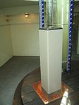
Amsterdam Ordnance Datum

Amsterdam Ordnance Datum or Normaal Amsterdams Peil (NAP) is a vertical datum in use in large parts of Western Europe. Originally created for use in the Netherlands, its height was used by Prussia in 1879 for defining Normalnull, and in 1955 by other European countries. In the 1990s, it was used as the reference level for the United European leveling Network (UELN) which in turn led to the European Vertical Reference System (EVRS).Mayor Johannes Hudde of Amsterdam in a way came up with the idea after he expanded the sea dike after a flood in Amsterdam in 1675. Of course a dike should be storm-resistant to protect a city against flooding, and in this case a margin of "9 feet and 5 inches" (2.67 m - margin is defined in Amsterdam feet) was deemed enough to cope with rising water. So he measured the water level of the adjacent sea arm, Het IJ and compared it with the water level in the canals within the city itself. He found that the water level at an average summer flood in the sea arm (when the water level reaches its maximum, not counting storms) was about the same as the level on the other side of the sea-dike, plus the margin of 9 feet and 5 inches. The relatively constant water level in the canals of Amsterdam, called Amsterdams Peil ("Amsterdam level", AP), equalled the level at summer flood at sea in the sea-inlet, which changes throughout the year. AP was carried over to other areas in the Netherlands in 1860, to replace locally used levels. In this operation, an error was introduced which was corrected (normalised) between 1885 and 1894, resulting in the Normaal Amsterdams Peil. Originally the zero level of NAP was the average summer flood water level in the IJ just north of the centre of Amsterdam (which was at the time, in 1684, the main shipping area, then still connected with the open sea). Currently it is physically realised by a brass benchmark on a 22-meter pile below the Dam square in Amsterdam. The brass benchmark in the Amsterdam Stopera (combined city hall and opera house), which is a tourist attraction, is no longer used as a reference point.

Nes (Amsterdam)
Nes (Amsterdam)

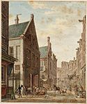
Nes ([ˈnɛs]; sometimes called de Nes, "the Nes") is a narrow, old, street in central Amsterdam, Netherlands. It runs parallel to and to the east of Rokin, between Dam Square to the north and Grimburgwal to the south. The Dutch word nes means headland or spit (compare the English word "ness", often found as a suffix in placenames). Until the seventeenth century, the northern part of Nes (roughly near where Dam Square now is) was called Gansoord ("Goose-oord"). (An oord (nl) is a piece of land between where two rivers meet.) The name most likely described the nature of the street's original situation among the waterways of Amsterdam. In the year 1500, there were around 20 monasteries in Amsterdam; of which five were in Nes. The street was nicknamed Gebed zonder End ("Prayer without end"). A side alley bears that name to this day (nl). Open practice of Catholicism was banned after the Alteratie of 1578, and the monasteries were given over to other uses. For example, the Binnengasthuis was founded as a hospital on the sites of the Old and New Nunneries. From early in the nineteenth century, Nes became a centre for entertainment. Its attractions included brothels, café-chantants, the Salon des Variétés, the Theatre Tivoli, and artists' cafés. Later, it became important in the tobacco trade. From 1911 (or earlier) until the mid 1930s, No. 17 was home to one of the earliest gay bars: The Empire. Since the 1960s, Nes has become known as a theatrical quarter; with sites including Frascati, Engelenbak, De Brakke Grond (a Flemish cultural centre), TOBACCO Theater (a rijksmonument), and the Comedy Theatre in de Nes.