South River City, Austin, Texas
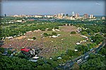
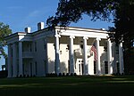
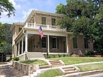
South River City is a community located in Austin, Texas. Also frequently called Travis Heights, the neighborhood is located south of the city's urban core, just below Lake Lady Bird in South Austin. The area encompasses a portion of ZIP code 78704. South River City is bounded to the west by South Congress Avenue and the Bouldin Creek neighborhood, to the south by Oltorf Road and to the east by Interstate 35 and East Riverside-Oltorf Combined Neighborhood Planning Area. To the north, South River City abuts Lake Lady Bird and Riverside Drive. South River City together with the St. Edward's neighborhood located directly to the south, comprise a City of Austin Combined Planning Area called Greater South River City.The area known as South River City developed in the late 19th and early 20th century as Austin's first planned urban communities south of the Colorado River. Swisher's Addition and Fairview Park, the first two attempts at settlement in present-day South River City were troubled by the lack of transportation with Downtown Austin. However, the concrete Congress Avenue Bridge was completed in 1910, thus laying the groundwork for a neighborhood boom in the 1920s and 1930s. Many of the homes built were single-family, and some of those that remain are Victorian-era structures with gingerbread trim, Craftsman-influenced bungalows, and housed influenced by the Prairie School style. Many houses have gabled or hipped roofs and deep porches.
Excerpt from the Wikipedia article South River City, Austin, Texas (License: CC BY-SA 3.0, Authors).South River City, Austin, Texas
Barton Hills Drive, Austin
Geographical coordinates (GPS) Address Nearby Places Show on map
Geographical coordinates (GPS)
| Latitude | Longitude |
|---|---|
| N 30.258055555556 ° | E -97.781111111111 ° |
Address
Barton Hills Drive 1804
78704 Austin
Texas, United States
Open on Google Maps


