place

Zilker Botanical Garden

Botanical gardens in TexasCulture of Austin, TexasGeography of Austin, TexasJapanese gardens in the United StatesProtected areas of Travis County, Texas
Tourist attractions in Austin, Texas
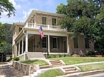
ZilkerBotanicalGarden Entrance

The Zilker Botanical Garden (31 acres; 125,000 m²) is a botanical garden of varied topography located on the south bank of the Colorado River at 2220 Barton Springs Road, near downtown Austin, Texas, United States. Theme gardens include the Taniguchi Japanese Garden, The Riparian Streambed, The Hartman Prehistoric Garden, and The Mabel Davis Rose Garden.The Botanical Garden was established as a non-profit organization in 1955, and is the centerpiece of Zilker Park. It features several independently maintained gardens, each of a particular focus: City of Austin's Green Garden Cactus and Succulent Garden Hartman Prehistoric Garden Herb and Fragrance Garden Isamu Taniguchi Oriental Garden Mabel Davis Rose Garden Doug Blachly Butterfly Trail and Garden Pioneer Village

Excerpt from the Wikipedia article Zilker Botanical Garden (License: CC BY-SA 3.0, Authors, Images).

Zilker Botanical Garden
South Mopac Expressway, Austin

Geographical coordinates (GPS) Address External links Nearby Places
placeShow on map

Wikipedia: Zilker Botanical GardenContinue reading on Wikipedia

Geographical coordinates (GPS)

Latitude Longitude
N 30.2689 ° E -97.7714 °
placeShow on map

Address

Zilker Botanical Garden

South Mopac Expressway
78703 Austin
Texas, United States
mapOpen on Google Maps

linkWikiData (Q8071897)
linkOpenStreetMap (313444169)

ZilkerBotanicalGarden Entrance
Share experience

Nearby Places

Zilker Holiday Tree
Zilker Holiday Tree

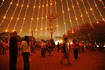
The Zilker Holiday Tree is a 155 foot Christmas tree made from lights draped from a moonlight tower located in Zilker Park (Austin, Texas). During the Christmas season the tree is lit by over 3000 colored lights. The lighting of the tree has been an annual tradition in Austin since 1967. On December 26, 2010, a five-kilometer run named after the tree took place.The Zilker Holiday Tree stands 155 feet tall and is composed of 39 streamers, each holding 81 multicolored, 25-watt bulbs - totaling 3,309 lights. At the top of the tree, a double star measures 10 feet from point to point. The double star displays 150 frosted bulbs. This unique spiral pattern of lights was created by City of Austin electricians. At its circumference, the tree measures 380 feet. The diameter is 120 feet. The base of the tree is made up of 19 utility poles, each 14 feet tall, arranged in a circle around the Moonlight Tower. On December 10, 1967, the first tree was lighted by Mayor Pro Tem Mrs. Emma Long. In subsequent years this honor has been awarded to the young winner of a city-wide tree art contest. Facts about the holiday tree: The Zilker Moontower is 1 of 17 original Austin towers. Currently 15 remain. 155 feet tall 380 fee circumference, 120 feet diameter 19 utility poles at the base of the historic moontower 39 streamers Each streamer holds 81 multi-color bulbs (converted to LED in 2019) 3309 total lights A double star tops the display measuring 10 feet from point to point On December 10, 1967, the first tree was lighted by Mayor Pro Tem Mrs. Emma LongThe Moontowers Originally purchased from the City of Detroit in 1894, these 165-foot-tall towers were installed to help keep Austin streets illuminated and keep residents safe. Austin is the only city in the country that still operates moonlight towers (or moon towers, as they're better known in Austin). In the 1890's the towers were powered with bright carbon-arc bulbs. In 1970, they were proclaimed Texas State Landmarks and were recognized in the U.S. National Register of Historic Places six years later. 2016 Zilker Moontower Restoration Project In 2016 Austin Energy restored the historic moontower. The project deep-cleaned each of the tower's individual parts and repaired aging items. The restoration included new LED light bulbs that are brighter and more energy efficient, "saving approximately 131,400 kilowatt-hours annually, which is the equivalent of powering 11 average-sized homes year-round," according to Austin Energy.

West Line Historic District (Austin, Texas)

The West Line Historic District is a residential community in central Austin, Texas, United States. The district encompasses an approximately 90-block tract of land located west of downtown. Bounded by Baylor Street to the east, Fifth Street to the south, Thirteenth Street to the north and Texas State Highway Loop 1 to the west. It is located south of the Old West Austin Historic District and southeast of the Clarksville Historic District.The district comprises more than twenty-five subdivisions platted between 1871 and 1948, out of the George W. Spear League and Division Z of the government lands west of the original city center. Early settlement in the area consisted of expansive estates, later subdivided in response to the city's burgeoning population. After the 1887 construction of the West Sixth Street Bridge over Shoal Creek, the West Sixth Street streetcar line, commonly referred to as the West Line, extended into the district from downtown and facilitated the development of suburban tracts. Due to the piecemeal development and hilly topography of the area, the streets form an irregular rectilinear grid. A number of notable nineteenth-century residences and institutional buildings exist throughout the district, but the preponderance of resources consist of Craftsman and Classical Revival-influenced bungalows built during the height of the area's development from the 1910s-1930s. In keeping with the original developers’ intentions, the historic district maintains strong residential characteristics.The area was added to the National Register of Historic Places in 2005. It includes the neighborhoods of Raymond Heights, Raymond Plateau and Shelley Heights.