place

Königshütte Waterfall

Bode basinHarzOberharz am BrockenWaterfalls of Germany
KoenigshuetteWasserfall

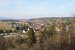
Königshütte Waterfall (German: Königshütter Wasserfall) is a waterfall in the village of Königshütte in the borough of Oberharz am Brocken in the Harz Mountains of Central Germany. The waterfall has a relatively low volume and falls through a height of 12 metres (some sources give 15 or 20 metres). The stream empties shortly thereafter into the Kalte Bode. The waterfall is man-made and was constructed in connexion with an old quarry in 1994. The Bundesstraße 27 federal road runs close by. The area around the waterfall has been turned into a small park area. At the top of the falls at the viewing point is checkpoint no. 40 in the Harzer Wandernadel hiking network.

Excerpt from the Wikipedia article Königshütte Waterfall (License: CC BY-SA 3.0, Authors, Images).

Königshütte Waterfall
Neue Hütte, Oberharz am Brocken

Geographical coordinates (GPS) Address Nearby Places
placeShow on map

Wikipedia: Königshütte WaterfallContinue reading on Wikipedia

Geographical coordinates (GPS)

Latitude Longitude
N 51.75101 ° E 10.75373 °
placeShow on map

Address

Neue Hütte
38875 Oberharz am Brocken
Saxony-Anhalt, Germany
mapOpen on Google Maps

KoenigshuetteWasserfall
Share experience

Nearby Places

Königshütte Dam
Königshütte Dam

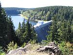
The Königshütte Dam (German: Talsperre Königshütte) is a dam in the German state of Saxony-Anhalt in the Harz mountains. It impounds the River Bode and lies between Königshütte and Susenburg (both in the borough of Oberharz am Brocken). It is a so-called storage reservoir (Überleitungssperre) forming part of the Rappbode Dam system. The dam itself was built on the Bode from 1939 to 1943 and 1952–1956 with construction being interrupted by the war. It is an 18 metre high gravity dam, made of concrete, for the supply of drinking water and for flood protection. It also provides reserves of water during times of drought and hydro-electric power. The power station has a nominal output of 60 kW and generates 0.18 GWh per annum. The gently curving dam wall is 108 m long and has a volume of 13,500 m³. It can be overtopped along almost its entire length. In one section there is a fish-belly flap gate that can be lowered by 1.5 metres to provide flood control. The reservoir has a capacity of 1.2 million m³ and covers an area of 32 hectares. Part of the water is diverted from here through a 1,795 m long tunnel to the Rappbode Reservoir. The rest flows back into the Bode and down to the Wendefurth Reservoir, where it is reunited with the water from the Rappbode Reservoir again. A quiet concrete road from Königshütte runs along the northern side of the reservoir as far as the dam. On the south side a wide footpath leads back to Königshütte, which passes the confluence of the Kalte and Warme Bode. Numerous footpaths lead from the dam in almost all directions of the compass. The location is suitable for both anglers and walkers.