place

Cedar Hill, Ohio

Columbus metropolitan area, Ohio geography stubsUnincorporated communities in Fairfield County, Ohio
Cedar Hill Methodist Church in snow

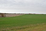
Cedar Hill is an unincorporated community in northern Amanda Township, Fairfield County, Ohio, United States. It lies at the intersection of Lancaster-Circleville (SR-188), Cedar Hill, and Westfall Roads. Located in the west of the county, it lies west of Lancaster (the county seat of Fairfield County) and south of the village of Lithopolis.

Excerpt from the Wikipedia article Cedar Hill, Ohio (License: CC BY-SA 3.0, Authors, Images).

Cedar Hill, Ohio
Westfall Road Southwest, Amanda Township

Geographical coordinates (GPS) Address Nearby Places
placeShow on map

Wikipedia: Cedar Hill, OhioContinue reading on Wikipedia

Geographical coordinates (GPS)

Latitude Longitude
N 39.691111111111 ° E -82.805555555556 °
placeShow on map

Address

Westfall Road Southwest 10494
43102 Amanda Township
Ohio, United States
mapOpen on Google Maps

Cedar Hill Methodist Church in snow
Share experience

Nearby Places

Stevenson Peters House

The Stevenson Peters House is a historic farm complex near the city of Circleville in Pickaway County, Ohio, United States. Built in the mid-19th century, the complex has been named a historic site. Stevenson Peters was descended from one of Pickaway County's earliest families of settlers. By the mid-19th century, Peters had made himself one of Walnut Township's most extensive landowners. On the present property he erected the present house in 1852, and here he resided until his death in 1887. Later generations of the Peters family owned the property until 1978, when it was inherited by a family named Bartholomew. Accordingly, it has also been known as the "Peters-Bartholomew Residence."Peters' farmhouse is a brick double-pen building with four-over-four windows, two-and-a-half stories tall and five bays wide. Because of its location on a hill, the house appears especially large to the viewer and can be seen from a particularly long distance. Nine additional buildings are located on the farmstead, which encompasses approximately 2 acres (0.81 ha) around the house.In 1984, the Peters House was listed on the National Register of Historic Places, qualifying because of its distinctive historic architecture. Six of the ten buildings on the farmstead qualified as contributing properties, while the other four were deemed non-contributing. Particularly crucial to this designation was its four-over-four design, which represented an uncommon variation in its rural area.