Tripontium
Borough of RugbyFormer populated places in WarwickshireHistory of WarwickshirePopulated places established in the 1st centuryRoman fortifications in England ... and 4 more
Roman towns and cities in EnglandScheduled monuments in WarwickshireStructures on the Heritage at Risk registerStructures on the Heritage at Risk register in Warwickshire

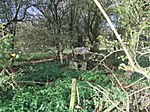
Tripontium (Latin for "Place of three bridges") was a town in Roman Britain. It lay on the Roman road later called Watling Street (and known today as the A5) at a site now chiefly within the civil parish of Churchover in the English county of Warwickshire and partly in Leicestershire, some 3.4 miles north-east of Rugby and 3.1 miles south of Lutterworth.
Excerpt from the Wikipedia article Tripontium (License: CC BY-SA 3.0, Authors, Images).Tripontium
Hardt,
Geographical coordinates (GPS) Address Nearby Places Show on map
Geographical coordinates (GPS)
| Latitude | Longitude |
|---|---|
| N 52.409152 ° | E -1.212683 ° |
Address
Hardt 10
51588
Nordrhein-Westfalen, Deutschland
Open on Google Maps


