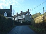
Bucknell, Shropshire
Civil parishes in ShropshireEngvarB from September 2013Villages in Shropshire

Bucknell is a village and civil parish in south Shropshire, England. The village lies on the River Redlake, within 660 yards (600 m) of the River Teme and close to the border of Wales and Herefordshire. It is about 6 miles (9.7 km) east of Knighton and is set within the Shropshire Hills Area of Outstanding Natural Beauty. The name is derived from Old English and means 'Bucca's hill' or 'he-goats' hill'.The village has the "P"s identified by Country Life as essential to a successful village: a pub, a post office, a place of worship, a primary school and public transport.
Excerpt from the Wikipedia article Bucknell, Shropshire (License: CC BY-SA 3.0, Authors, Images).Bucknell, Shropshire
Route du Fort de Bouc, Istres
Geographical coordinates (GPS) Address Nearby Places Show on map
Geographical coordinates (GPS)
| Latitude | Longitude |
|---|---|
| N 52.36 ° | E -2.95 ° |
Address
Route du Fort de Bouc
13500 Istres
Provence-Alpes-Côte d'Azur, France
Open on Google Maps


