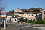
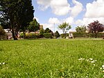
Kea ( KEE; Cornish: Sen Ke) is a civil parish and village in Cornwall, England, United Kingdom. It is a "large straggling parish" in a former mining area south of Truro.
Kea village is situated just over one mile (1.6 km) southwest of Truro.Old Kea is situated two miles (3 km) to the east on the west bank of the Truro River at grid reference SW 843 417. St Kea reputedly landed at Old Kea on his first visit to Cornwall and established a church there, which was the parish church until replaced by All Hallows. His life is described in the medieval Cornish language play Bewnans Ke (The Life of St Kea, c. 1550).
Today, the parish is mainly agricultural, and is noted for giving its name to the damson-type Kea plum. It is bounded to the north by Calenick Creek and Truro civil parish; to the east by the Truro River and River Fal; to the south by the parishes of Feock, Perranarworthal and Gwennap; and to the west by Kenwyn. Other settlements in the parish include Calenick, Come-to-Good, Killiow, Nansavallan, Playing Place, Porth Kea, and the tiny hamlet of Quenchwell consisting of a few houses and a chapel. It takes its name from the Quench-well, a natural spring.Kea was described in 1870–72, John Marius Wilson's Imperial Gazetteer of England and Wales (1870) as:
A parish and a sub-district in Truro district, Cornwall. The parish lies on the Falmouth and Redruth railways, 2¼ miles SSW of Truro; is bounded, on the E, by the river Fal, on the N, by Kenwyn, on the W, by Gwennap; and contains parts of the chapelries of Baldhu, Chacewater, and Mithian. Real property £7,158 of which £1,234 are in mines. Pop(ulation) in 1861 3,949. Houses, 824. The manor belongs to Viscount Falmouth.


