place

Catchall, Cornwall

Hamlets in CornwallPenwithPenwith geography stubs
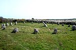
The Blind Fiddler Standing Stone geograph.org.uk 974553

Catchall is a hamlet in west Cornwall, England, UK. Catchall is 1 mile (1.6 km) south-east of Sancreed at around 310 feet (94 m) above sea level at the junction of the B3283 with the A30 main road.There are a number of prehistoric standing stones nearby that have been scheduled as ancient monuments by English Heritage; the Blind Fiddler, the Long Stones and Tresvennack Pillar are all within 1 mile (1.6 km) of Catchall. The Blind Fiddler is a single freestanding monolith measuring 3.3 by 1.9 by 0.4 metres (10.8 by 6.2 by 1.3 ft). The Long Stones (also known as the "Sisters" or "Triganeeris Stones") are two upright monoliths standing approximately 5.5 metres (18 ft) apart. Both stones are over 2 metres (6 ft 7 in) high. Excavations revealed that between the two stones is a rectangular pit. The Tresvennack Pillar is a single upright monolith with a large vertical crack and standing almost 4m high.The freehold tenement of Catchall, then being part of Hendra was sold by public auction on 23 June 1883. At the time of selling it was occupied by Mr William Jacka, on a yearly tenancy and included 3–4 acres (1.2–1.6 ha) for cultivation, a farmhouse, barn, stable two pig-houses, cart shed, etc. The tenement was purchased by Thomas Bedford Bolitho, a local banker and industrialist, who owned nearby Kerris.

Excerpt from the Wikipedia article Catchall, Cornwall (License: CC BY-SA 3.0, Authors, Images).

Catchall, Cornwall
Penzance Road,

Geographical coordinates (GPS) Address Nearby Places
placeShow on map

Wikipedia: Catchall, CornwallContinue reading on Wikipedia

Geographical coordinates (GPS)

Latitude Longitude
N 50.094 ° E -5.594 °
placeShow on map

Address

Penzance Road

Penzance Road
TR19 6AF , Sancreed
England, United Kingdom
mapOpen on Google Maps

The Blind Fiddler Standing Stone geograph.org.uk 974553
Share experience

Nearby Places

Sancreed Parish Church

Sancreed Parish Church is the parish church of Sancreed, Cornwall, England, UK. It is an Anglican church in the Diocese of Truro. Sancreed Parish church (Grade II Listed) lies at the heart of the village and is dedicated to St Sancredus. The church is built of granite, parts of which date back to the 13th and 14th-centuries which was originally built in a cruciform shape. The current church has an unbuttressed west tower of two stages, a north transept and a 15th-century south aisle of five bays. Features of interest include the fine font which is of the St Ives type dating from the 14th-century and the rood screen which has curious carvings at the base. Much of the church was restored in 1881 by the architect J D Sedding and the contractor, Mr Bone of Liskeard. A report in The Cornishman newspaper stated, There was nothing striking about the old Church except its hoary and depressing appearance. It contained a few pieces of good carved work, which doubtless will be utilized in the restoration, but very few other specimens of art. The churchyard and church have, within the late 19th and first part of the 20th-century, made a strong appeal to painters of the Newlyn School of Art, some of whom worshipped regularly at the church and are buried in the churchyard (including Stanhope Forbes RA). Work on replacing the church roof began in 2017 following a grant from the Heritage Lottery Fund of £227,100 and more than £11,000 from charities.