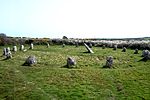
Sancreed
Civil parishes in CornwallHoly wells in CornwallPenwithVillages in Cornwall

Sancreed (Cornish: Eglossankres) is a village and civil parish in Cornwall, England, United Kingdom, approximately three miles (5 km) west of Penzance.Sancreed civil parish encompasses the settlements of Bejouans, Bosvennen, Botreah, Drift, Sancreed Churchtown, Trenuggo, and Tregonnebris. It is bounded by St Just parish to the west, Madron parish to the northeast, and St Buryan and Paul parishes to the south. The parish comprises 4,608 acres (18.65 km2) of land including Drift Reservoir, which provides drinking water for the area.
Excerpt from the Wikipedia article Sancreed (License: CC BY-SA 3.0, Authors, Images).Sancreed
Geographical coordinates (GPS) Address Nearby Places Show on map
Geographical coordinates (GPS)
| Latitude | Longitude |
|---|---|
| N 50.109 ° | E -5.61 ° |
Address
TR20 8QP , Sancreed
England, United Kingdom
Open on Google Maps


