place

Stamford Street

Streets in the London Borough of LambethStreets in the London Borough of SouthwarkUse British English from June 2015
London Day 4 2016 09 07 12 44 51 ILCE 6300 DSC09140 (29064661764)

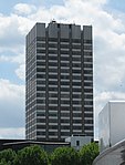
Stamford Street is a street in Lambeth and Southwark, London, England, just south of the River Thames. It runs between Waterloo Road to the west and Blackfriars Road to the east. It forms part of the A3200. The street has a wide variety of buildings. There are two large Georgian terraces, a school and the entrance to a chapel from the 1820s; a Victorian bank and hotel; an Edwardian hospital now used for student accommodation; early 20th century industrial buildings now forming the Waterloo campus of King's College London; office buildings from the 1930s and 70s; housing co-operatives from the 1980s and 90s; and a 21st-century residential tower with a second one under construction. At the western end, in the middle of a large roundabout, is the British Film Institute London IMAX Cinema.

Excerpt from the Wikipedia article Stamford Street (License: CC BY-SA 3.0, Authors, Images).

Stamford Street
Stamford Street, London Lambeth (London Borough of Lambeth)

Geographical coordinates (GPS) Address Nearby Places
placeShow on map

Wikipedia: Stamford StreetContinue reading on Wikipedia

Geographical coordinates (GPS)

Latitude Longitude
N 51.5066 ° E -0.1092 °
placeShow on map

Address

Stamford Street 70
SE1 9NN London, Lambeth (London Borough of Lambeth)
England, United Kingdom
mapOpen on Google Maps

London Day 4 2016 09 07 12 44 51 ILCE 6300 DSC09140 (29064661764)
Share experience

Nearby Places

South Bank
South Bank

The South Bank is an entertainment and commercial district in central London, next to the River Thames opposite the City of Westminster. It forms a narrow strip of riverside land within the London Borough of Lambeth (where it adjoins Albert Embankment) and the London Borough of Southwark, (where it adjoins Bankside). As such, the South Bank may be regarded as somewhat akin to the riverside part of an area known previously as Lambeth Marsh and North Lambeth. While the South Bank is not formally defined, it is generally understood to bounded by Westminster Bridge and Blackfriars Bridge, and to be centred approximately half a mile (800 metres) south-east of Charing Cross. The name South Bank was first widely used in 1951 during the Festival of Britain. The area's long list of attractions includes the County Hall complex, the Sea Life London Aquarium, the London Dungeon, Jubilee Gardens and the London Eye, the Southbank Centre, Royal Festival Hall, National Theatre, and BFI Southbank. In addition to their official and business functions, both the County Hall and the Shell Centre have major residential components. Due to it often being waterlogged in winter, the area was slower to develop than the "North Bank" of the Thames . Throughout its history, it has twice functioned as an entertainment district, interspersed by around a hundred years of wharfs, domestic industry and manufacturing being its dominant use. Restoration began in 1917 with the construction of County Hall at Lambeth replacing the Lion Brewery. Its Coade stone symbol was retained and placed on a pedestal at Westminster Bridge and is known as the South Bank Lion. The pedestrianised embankment is The Queen's Walk, which is part of the Albert Embankment built not only for public drainage but also to raise the whole tract of land to prevent flooding.In 1951 the Festival of Britain redefined the area as a place for arts and entertainment. It now forms a significant tourist district in central London, stretching from Blackfriars Bridge in the east to Westminster Bridge in the west. A series of central London bridges connect the area to the northern bank of the Thames Golden Jubilee and Waterloo Bridge.