place

Broadwoodkelly

Devon geography stubsVillages in Devon
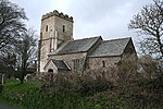
Church of All Hallows, Broadwoodkelly (geograph 2816392)

Broadwoodkelly is a village and civil parish in the West Devon district of Devon, England. According to the 2001 census it had a population of 218. The village is situated about 9 miles (14 km) north of Okehampton. Much of the church is 15th century, but it has two piscinae 700 years old, an ancient granite baptismal font, an elizabethan table, and a stained-glass window dated 1523.

Excerpt from the Wikipedia article Broadwoodkelly (License: CC BY-SA 3.0, Authors, Images).

Broadwoodkelly
West Devon Broadwoodkelly

Geographical coordinates (GPS) Address Nearby Places
placeShow on map

Wikipedia: BroadwoodkellyContinue reading on Wikipedia

Geographical coordinates (GPS)

Latitude Longitude
N 50.8357 ° E -3.966 °
placeShow on map

Address


EX19 8ED West Devon, Broadwoodkelly
England, United Kingdom
mapOpen on Google Maps

Church of All Hallows, Broadwoodkelly (geograph 2816392)
Share experience

Nearby Places

Honeychurch, Devon
Honeychurch, Devon

Honeychurch is a village and former civil parish now in the parish of Sampford Courtenay, in the West Devon district of the English county of Devon. It was originally an ancient parish in the Black Torrington hundred of northwest Devon. With about thirty inhabitants in 1066, the village is mentioned in the Domesday Book as "Honechercha". The description mentions five farms, which are still in operation in the 21st century. In 1870-72, John Marius Wilson's Imperial Gazetteer of England and Wales described Honeychurch in the following: "HONEY-CHURCH, a parish in Okehampton district, Devon; near the river Taw, 2 miles WNW of North Tawton r. station, and 5½ ESE of Hatherleigh. Posttown, North Tawton, North Devon. Acres, 607. Real property, £497. Pop., 44. Houses, 9. The property is subdivided; and the manor belongs to the Earl of Portsmouth. The living is a rectory in the diocese of Exeter. Value, £93. Patron, the Rev. Dr. Brailsford. The church is old, and has a tower." On 31 December 1894 the parish was abolished and merged with Sampford Courtenay. By 1894 there were only 8 houses. The parish had 66 inhabitants in 1801, 69 in 1848, 35 in 1891, and 44 in 1901.The 12th-century church, dedicated to Mary, is largely in its original state, save for the addition of the 15th-century three-bell tower and 16th-century portico in the south facade. The name of the village refers to the previous building on this site, "Huna's church", founded in the 10th century by the Saxon landowner Huna.

Exbourne
Exbourne

Exbourne is a village and civil parish in the English county of Devon. The Anglo-Saxon origin of the name is gæces burn - Cuckoo Stream. It occupies a hillside location between the River Okement and the Hole Brook, about 5 miles north of Okehampton in West Devon, and height above sea level ranges between 280 Ft. and 484 Ft. It lies in a primarily agricultural location and the local parish council represents both Exbourne and nearby Jacobstowe. The population of the ward which represents Exbourne and all surrounding villages was 1,695 at the 2011 census.The village contains a Conservation Area, in which the principle building is the Church of St.Mary with its embattled tower and some fabric dating from XIV c. The present Manor House was built ca. 1830, and the manorial court was formerly held at Court Barton. There is a Church of England Primary School which has three classes with about sixty children on roll.. Other public buildings include the Methodist Chapel and the Village Hall, which was formerly the Manor Hall. An early Bible Christian chapel and Sunday School still stand, converted for residential use. The public house is called the 'Red Lion' which has undergone extensive work.There is an eco-friendly underground community shop, cafe and post office (opened 2012), which has been funded through grants and local funding.A garage, filling station and car workshop (RB Tyres) lies at the crossroads with the A3072. At the boundary with Jacobstowe stands an ancient packhorse bridge over the Okement river.