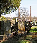
Ebenezer, South Carolina
Neighborhoods in South CarolinaRock Hill, South CarolinaSouth Carolina geography stubsUse mdy dates from July 2023

Ebenezer or Ebenezerville is a neighborhood of Rock Hill, South Carolina located at latitude 34.957 and longitude -81.046 along Ebenezer Road in the northern part of the city. Ebenezer was a town in northern York County, South Carolina until it was unincorporated and annexed into the city of Rock Hill in the late 1960s. The elevation of the neighborhood is 686 feet above sea level.
Excerpt from the Wikipedia article Ebenezer, South Carolina (License: CC BY-SA 3.0, Authors, Images).Ebenezer, South Carolina
Ebenezer Road, Rock Hill
Geographical coordinates (GPS) Address Nearby Places Show on map
Geographical coordinates (GPS)
| Latitude | Longitude |
|---|---|
| N 34.957222222222 ° | E -81.046388888889 ° |
Address
Ebenezer Road
Ebenezer Road
29732 Rock Hill
South Carolina, United States
Open on Google Maps


