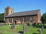
Hale, Halton
Borough of HaltonCivil parishes in CheshireUse British English from July 2021Villages in Cheshire

Hale is a village and civil parish in the Borough of Halton, Cheshire, England with a population of 1,800. The village is north of the River Mersey, and just to the east of the boundary with Merseyside. It is 3 miles east of Speke in Liverpool, and 4 miles south-west of Widnes. The nearby village of Halebank is to the north-east. Within the boundaries of the historic county of Lancashire, until 1 April 1974 the area formed part of the Whiston Rural District.
Excerpt from the Wikipedia article Hale, Halton (License: CC BY-SA 3.0, Authors, Images).Hale, Halton
Cocklade Lane,
Geographical coordinates (GPS) Address Nearby Places Show on map
Geographical coordinates (GPS)
| Latitude | Longitude |
|---|---|
| N 53.33673 ° | E -2.80007 ° |
Address
Cocklade Lane
Cocklade Lane
L24 4BD , Hale
England, United Kingdom
Open on Google Maps


