place

Brotherton

Civil parishes in North YorkshireKnottingleyNorth Yorkshire geography stubsSelby DistrictUse British English from March 2015
Villages in North Yorkshire
Brotherton, Church of St Edward the Confessor

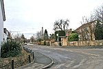
Brotherton is a village and civil parish in the Selby District of North Yorkshire, England. The village is on a border with the City of Wakefield and West Yorkshire (here formed by the River Aire).

Excerpt from the Wikipedia article Brotherton (License: CC BY-SA 3.0, Authors, Images).

Brotherton
High Street,

Geographical coordinates (GPS) Address Nearby Places
placeShow on map

Wikipedia: BrothertonContinue reading on Wikipedia

Geographical coordinates (GPS)

Latitude Longitude
N 53.72742 ° E -1.27151 °
placeShow on map

Address

High Street
WF11 9FB
England, United Kingdom
mapOpen on Google Maps

Brotherton, Church of St Edward the Confessor
Share experience

Nearby Places

Ferry Bridge, Brotherton

Ferry Bridge is a historic bridge, connecting Ferrybridge in West Yorkshire with Brotherton in North Yorkshire, in England. There may have been a bridge over the River Aire at this location in the Anglo-Saxon period, which has been supposed to have been destroyed in 1070. The first bridge known definitely to have existed was built in the late 12th century, but it collapsed in 1228, killing a group of Crusaders who were crossing. That year, pontage was granted, a toll for crossing the bridge, to fund repairs.A replacement bridge was built in about 1290, with a bridge chapel completed by 1306. In 1461, during the War of the Roses, the Lancastrian Army partly destroyed the bridge, but the Yorkist Army was still able to cross, on its way to the Battle of Towton. The bridge was restored, and it was described by John Leland in 1538 as being built of stone and having seven or eight arches. Four small arches at its north end took the road across swampy ground. This route became part of the Great North Road in the early Georgian period, with coaching inns established on each riverbank. The bridge was Grade I listed in 1967. The bridge was damaged by storms in 1795, and in 1797 John Carr of York designed a replacement, on a new alignment. Bernard Hartley constructed the bridge, which was completed in 1804. It is carried by eight round-headed arches: three to cross the river, four over land on the Ferrybridge side, and one over land on the Brotherton side. The piers have cutwaters and the bridge has a parapet, with refuges over each pier, and a vase balustrade in the central section.

Ferrybridge power stations

The Ferrybridge power stations were a series of three coal-fired power stations on the River Aire near Ferrybridge in West Yorkshire, England, in operation from 1927 to 2016 on a site next to the junction of the M62 and A1(M) motorways. The first station, Ferrybridge A, was constructed in the mid-1920s and closed in 1976. Ferrybridge B was brought into operation in the 1950s and closed in the early 1990s. In 1966, Ferrybridge C power station was opened with a generating capacity of 2 GW from four 500 MW sets; constructed by the Central Electricity Generating Board (CEGB); on privatisation in 1989 ownership was passed to Powergen, then to Edison Mission Energy (1999), then to AEP Energy Services (American Electric Power) (2001) and to SSE plc (2004). Ferrybridge C closed in March 2016. Two of the four units were fitted with flue-gas desulphurisation (FGD) plant in 2009. In 2013 SSE indicated that the power station would not comply with the Industrial Emissions Directive, requiring the plant's closure by 2023 or earlier. It was later announced that the plant would be fully closed by March 2016.Ferrybridge Multifuel 1 is a 68 MW multi-fuel energy-from-waste plant at the site which became operational in 2015. Ferrybridge Multifuel 2 is a 70 MW multi-fuel plant built alongside the MF1 plant, which became operational in 2019.On 28 July 2019, one of Ferrybridge's cooling towers was demolished, followed by a further four on 13 October. The main boiler house, bunker bay and two chimney stacks were demolished on 22 August 2021. The final three cooling towers were demolished on 17 March 2022.

Fryston Hall
Fryston Hall

Fryston Hall was a country house at Water Fryston, West Yorkshire which stood in an estate between the town of Castleford and the River Aire near where the river is crossed by the A1(M). The main building was demolished in 1934 and only some outbuildings survive as farm buildings. The hall itself stood in 200 acres of parkland. Buried in one of the lawns is a stone coffin containing what were thought to be the remains of Thomas, 2nd Earl of Lancaster who was beheaded in 1322 on the orders of King Edward II. The coffin was excavated in March 1882 from a nearby field and re-interred at Fryston Hall at the request of the then owner. Fryston Hall was once occupied by George Crowle (1696–1754), MP for Hull and his brother Richard Crowle (1699–1757), also MP for Hull. The Crowle family developed coal mining on the estate but in 1788 the estate was sold to Richard Slater Milnes (1759–1804), the heir to a cloth fortune and MP for York, who improved the house and planted many trees. The estate passed down in the Milnes family from Richard to his son Robert Pemberton Milnes (1784-1858), MP for Pontefract. From him it descended to Richard Monckton Milnes, 1st Baron Houghton (1809-1885), the poet, writer and unsuccessful suitor of Florence Nightingale, and also an MP for Pontefract. His well-known library at the hall was devastated by fire in 1876. Richard's son, Robert (1858-1945), became a Liberal politician and was created Earl of Crewe in 1895 and Marquess of Crewe in 1911. Robert lived for a while at Fryston Hall before selling it by auction in 1905. The partially derelict hall was then demolished in 1934 and some of the stone used to build the Holy Cross Church at Airedale.