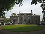
Borwick
Civil parishes in LancashireGeography of the City of LancasterLancashire geography stubsUse British English from March 2015Villages in Lancashire

Borwick is a village and civil parish in the City of Lancaster district of Lancashire, England, about 8 miles north of Lancaster, on the Lancaster Canal. It is situated just south of the border with Cumbria. The parish of Borwick had a population of 210 recorded in the 2001 census, decreasing to 181 at the 2011 Census. Borwick railway station was on the former Furness and Midland Joint Railway, now Leeds to Morecambe Line, until its closure in 1960.
Excerpt from the Wikipedia article Borwick (License: CC BY-SA 3.0, Authors, Images).Borwick
Borwick Lane, Lancaster
Geographical coordinates (GPS) Address Website Nearby Places Show on map
Geographical coordinates (GPS)
| Latitude | Longitude |
|---|---|
| N 54.151 ° | E -2.728 ° |
Address
Borwick Hall Outdoor Education Centre
Borwick Lane
LA6 1JU Lancaster
England, United Kingdom
Open on Google Maps


