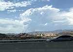
Neenach Volcano

Neenach Volcano is an extinct Miocene volcano in the Coastal Ranges of California. After formation, the volcanic field was split by a fault in the San Andreas Fault Zone, and over the last 23 million years, the two halves of the volcano have moved about 195 miles (314 kilometers) apart. The correlation of the two portions, now called the Pinnacles and Neenach volcanic formations, is significant; this correlation has become a “classic example” of plate tectonics for the scientific community. Ten rock types with nearly identical field, petrographic, and chemical characteristics are present in each formation in essentially the same stratigraphic order. This provides ample evidence for the correlation and interpreted movement along the San Andreas Fault. The volcano formed 23 million years ago during tectonic subduction of the oceanic Juan de Fuca Plate beneath the continental North American Plate, a process often associated with volcanic eruptions near the plate boundaries. Subsequent complex geophysical mechanisms caused a segment of the Juan de Fuca Plate to fuse to the eastern edge of the adjoining Pacific Plate, ending subduction and initiating horizontal shear movement between the plates, with the Pacific Plate moving northwesterly and the North American Plate moving in the opposite southeast direction. This transform movement began approximately 20 million years ago and the resultant shear lineation is the San Andreas Fault Zone. The Neenach Volcano was situated directly over the primary San Andreas fault, causing it to be split in two once the transform fault movement began. The average relative motion along the fault is about 1.5 cm per year, equivalent to six inches per decade. Over the course of this movement, the two halves of the volcano drifted about 195 miles (314 kilometers) apart and eroded down into the minor rock formations visible today.
Excerpt from the Wikipedia article Neenach Volcano (License: CC BY-SA 3.0, Authors, Images).Neenach Volcano
Three Points Road,
Geographical coordinates (GPS) Address Nearby Places Show on map
Geographical coordinates (GPS)
| Latitude | Longitude |
|---|---|
| N 34.749527777778 ° | E -118.59767222222 ° |
Address
Three Points Road
Three Points Road
California, United States
Open on Google Maps


