place

Bolton Percy

Bolton PercyCivil parishes in North YorkshireSelby DistrictUse British English from July 2019Villages in North Yorkshire
Bolton Percy Church
Bolton Percy Church

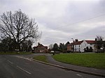
Bolton Percy is a village and civil parish in the Selby District of North Yorkshire, England. According to the 2001 census it had a population of 305 in 115 households, reducing marginally to 304 at the 2011 census. The village is about 4 miles (6.4 km) east of Tadcaster. The village was historically part of the West Riding of Yorkshire until 1974.

Excerpt from the Wikipedia article Bolton Percy (License: CC BY-SA 3.0, Authors, Images).

Bolton Percy
Low Farm Close,

Geographical coordinates (GPS) Address Nearby Places
placeShow on map

Wikipedia: Bolton PercyContinue reading on Wikipedia

Geographical coordinates (GPS)

Latitude Longitude
N 53.865671 ° E -1.190754 °
placeShow on map

Address

Low Farm Close

Low Farm Close
YO23 7AY
England, United Kingdom
mapOpen on Google Maps

Bolton Percy Church
Bolton Percy Church
Share experience

Nearby Places

All Saints' Church, Bolton Percy

All Saints' Church is the parish church of Bolton Percy, in North Yorkshire in England. There was a church in Bolton Percy at the time of the Domesday Book. The current church was built while Thomas Percy was rector, and it was consecrated on 8 July 1424 by Nicholas Warte, the Bishop of Dromore. The east window of the church was restored in 1866 by William Warrington, and the whole building was restored in 1890 by James Demaine and Walter Brierley, and in 1905 by John Bilson. The building was Grade I listed in 1967. It was again re-roofed in 2016, using a grant from the National Churches Trust. Given the size and quality of the building, it is locally nicknamed the "Cathedral of the Ainsty". The church is built of Magnesian Limestone and is roofed with stone slates. There is a west tower, a four-bay nave with aisles and a south porch, and then a three-bay chancel with a vestry on the north side. The tower has three stages; in 1844, it was recorded as having a fourth stage of later date, which has since been removed. It is supported with buttresses and is now topped by battlements. Most of the windows have three lights and are Perpendicular in style, with the East window having five lights. There are 14 stained glass windows, with the East and Millennium windows of most note.Inside, there is a pointed arch opening to the tower, and octagonal piers supporting the arcades. The font is Norman, with a Jacobean cover. There is a prayer desk of the same period, and a pulpit from the era of Charles II. There is also a sedilia with three gables, and a piscina with a carved angel at its base. There is a Mediaeval floor slab dedicated to Elizabeth Ryther, and several 17th century memorials, including a Baroque wall monument dedicated to Ferdinando Fairfax, 2nd Lord Fairfax of Cameron. The interior has oak box pews which are also Jacobean.

Bolton Percy Gatehouse

Bolton Percy Gatehouse is a historic building in the village of Bolton Percy, southwest of York in England. The gatehouse was built in the late 15th century, as the entrance to a courtyard of buildings including the village rectory. In the late 17th century, the main house was replaced by the current Old Rectory following which, the lower floor of the building was used as stables and as a cowhouse, while the upper floor was used as a granary. In 1799, the Crown Inn was built next to the gatehouse, at which time the western part of the building may have been reduced to one storey. The other buildings around the courtyard were demolished in the 19th century, and the gatehouse declined in importance. By 1938, the passageway through the gatehouse had been boarded up, and the building was disused for many years. It was considered for removal to the Avoncroft Museum of Historic Buildings, but was instead donated to the Bolton Percy Gatehouse Trust and restored on site, from 1972 to 1974. The western part of the building was not included in the restoration, and had partially collapsed by the 1990s. The building was later purchased by the Vivat Trust, which in 2010 converted it into a two-bedroom house, to be used as a holiday let. The trust went bankrupt in 2016, and the property was sold, but continued in use as a holiday home.The building is entirely timber framed, and is built of oak, with infill, over a plinth of Magnesian Limestone. It is two storeys high and three bays wide, one containing the carriage arch. The first floor is jettied. Inside, there are various carvings in the roof braces, including a Tudor rose. The windows are modern. The building has been Grade II* listed since 1980.

RAF Church Fenton
RAF Church Fenton

Royal Air Force Church Fenton or RAF Church Fenton (ICAO: EGCM) is a former Royal Air Force (RAF) station located 4.3 miles (6.9 km) south-east of Tadcaster, North Yorkshire, England and 6.3 miles (10.1 km) north-west of Selby, North Yorkshire, near the village of Church Fenton. The station was opened in 1937 and during the Second World War was home to air defence aircraft, a role retained by the Station until the 1960s when it became a training station. The last Station Commander of a self-determining RAF Church Fenton was Sqn Ldr David Morris, who had trained on Chipmunk aircraft at RAF Church Fenton in 1973. Sqn Ldr Morris returned to RAF Church Fenton in 1991 as the Officer Commanding Station Services Squadron, to prepare the as then autonomous station for yet another closure, and transfer into the control of RAF Linton on Ouse as a satellite airfield and Enhanced Relief Landing Ground. The gates of the fully independent RAF Church Fenton were closed at 12:00 on 31 December 1992, However, with its assets such as the Officers' Mess subsequently razed to the ground to save on maintenance, and the married quarters and other buildings sold off piecemeal by the MoD, RAF Church Fenton's runways and aviation infrastructure were alienated from the remainder of the administrative site and remained operational until 2013. The satellite airfield Enhanced Relief Landing Ground was sold in 2013 and is now a civilian airfield known as Leeds East Airport.