Oele
HengeloPopulated places in Overijssel

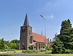
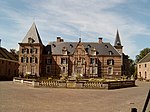
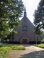
Oele (in old Dutch also: Eule, Dutch Low Saxon: Eul) is a village in the municipality Hengelo in the Dutch province of Overijssel. It is located south-west of Hengelo, south of the Twentekanaal. The highway A35 and the Provincial road 739|N739 (the road from Hengelo to Beckum and Haaksbergen) are close to the population centre. Until the creation of the municipality of Hengelo, Oele was part of the richterambt Delden.
Excerpt from the Wikipedia article Oele (License: CC BY-SA 3.0, Authors, Images).Oele
Albersdijk,
Geographical coordinates (GPS) Address Nearby Places Show on map
Geographical coordinates (GPS)
| Latitude | Longitude |
|---|---|
| N 52.243611111111 ° | E 6.7522222222222 ° |
Address
Albersdijk
Albersdijk
7554 RJ
Overijssel, Netherlands
Open on Google Maps


