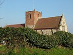
Blundeston

Blundeston is a village and civil parish in the north of the English county of Suffolk. It is 3.5 miles (5.6 km) north-west of Lowestoft, 6 miles (9.7 km) south of Great Yarmouth and around 1.75 miles (2.82 km) inland from the North Sea coast. It is part of the area known as Lothingland in the East Suffolk district. Blundeston Prison was located on the southern edge of the village but closed in early 2014.The parish had a population of 1,637 at the 2011 United Kingdom census. It extends from the River Waveney, which marks the county border with Norfolk, in the west to the A47 road in the east. It borders the Suffolk parishes of Corton, Flixton, Oulton, Lound and Somerleyton, Ashby and Herringfleet as well as the Norfolk parish of Burgh St Peter across the Waveney. The parish council is operated jointly with the sparsely populated parish of Flixton to the south.The village is clustered in the centre of the parish. The Lowestoft to Norwich railway line crosses the western section of the parish, with the nearest station at Somerleyton railway station. This part of the parish consists of a series of drainage marshes in the floodplain of the Waveney. The B1075 Lowestoft to Somerleyton road crosses the parish.
Excerpt from the Wikipedia article Blundeston (License: CC BY-SA 3.0, Authors, Images).Blundeston
Church Road, East Suffolk
Geographical coordinates (GPS) Address Nearby Places Show on map
Geographical coordinates (GPS)
| Latitude | Longitude |
|---|---|
| N 52.516 ° | E 1.707 ° |
Address
Church Road
NR32 5AJ East Suffolk
England, United Kingdom
Open on Google Maps


