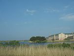
Caergeiliog
Anglesey geography stubsLlanfair-yn-NeubwllVillages in Anglesey

Caergeiliog is a village in Anglesey, in north-west Wales. It is in the community of Llanfair-yn-Neubwll and has a population of 355. The name derives from Welsh, and is a combination of Caer, meaning 'castle' or 'fort', and ceiliog, meaning 'cockerel'. It is unclear where the second element came from.
Excerpt from the Wikipedia article Caergeiliog (License: CC BY-SA 3.0, Authors, Images).Caergeiliog
Holyhead Road,
Geographical coordinates (GPS) Address Nearby Places Show on map
Geographical coordinates (GPS)
| Latitude | Longitude |
|---|---|
| N 53.274708 ° | E -4.534475 ° |
Address
Holyhead Road
LL65 3YA , Llanfair-yn-Neubwll
Wales, United Kingdom
Open on Google Maps


