La Teste-de-Buch

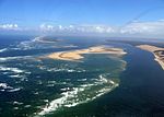
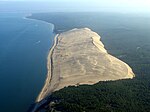
La Teste-de-Buch (French pronunciation: [la tɛst də byʃ]; Occitan: La Tèsta (de Bug), [la ˈtɛstə (ðe ˈβyc)]; lit. "La Teste-of-Buch") is a coastal commune in the Gironde department in the Nouvelle-Aquitaine region in Southwestern France. Until 13 June 1994, it was officially known simply as La Teste.The commune is located on the south shore of Arcachon Bay (Bassin d'Arcachon) and on the Atlantic coast of France, lying in the southwestern part of Gironde, on the departmental border with Landes. It is the eighth-largest commune in metropolitan France in geographical area at 180.20 km2 (69.58 sq mi). It is the largest and most populated of the four communes that make up the Communauté d'agglomération Bassin d'Arcachon Sud (COBAS), which coincides with the urban unit (agglomeration) of La Teste-de-Buch-Arcachon, population 67,563 (2018). La Teste-de-Buch proper had a population of 26,269 as of 2020.La Teste-de-Buch is famous for the Dune of Pilat (Dune du Pilat), the highest sand dune in Europe. It is also the site of a fictional battle during the Napoleonic wars depicted in Sharpe's Siege by Bernard Cornwell.
Excerpt from the Wikipedia article La Teste-de-Buch (License: CC BY-SA 3.0, Authors, Images).La Teste-de-Buch
Rue Jean Lestage, Arcachon
Geographical coordinates (GPS) Address Nearby Places Show on map
Geographical coordinates (GPS)
| Latitude | Longitude |
|---|---|
| N 44.62 ° | E -1.145711 ° |
Address
Rue Jean Lestage
33260 Arcachon
Nouvelle-Aquitaine, France
Open on Google Maps


