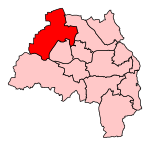
Denton Burn
Districts of Newcastle upon TyneTyne and Wear geography stubsUse British English from July 2015
Denton Burn is an area located in Central Newcastle, approximately 4 miles (6 km) to the west of the city centre of Newcastle upon Tyne in England, United Kingdom. It is officially designated a suburb of the city, where it is linked to Carlisle by the A69 and A1 roads. The West Road also runs to the north of Denton Burn allowing access to the city centre and also to the junction which leads to the A69 road and A1 road.
Excerpt from the Wikipedia article Denton Burn (License: CC BY-SA 3.0, Authors).Denton Burn
Heathwell Road, Newcastle upon Tyne Lemington
Geographical coordinates (GPS) Address Nearby Places Show on map
Geographical coordinates (GPS)
| Latitude | Longitude |
|---|---|
| N 54.983219 ° | E -1.693912 ° |
Address
Heathwell Road
Heathwell Road
NE15 7UQ Newcastle upon Tyne, Lemington
England, United Kingdom
Open on Google Maps


